There are three places on the South Island where the official Te Araroa route is discountinuous. The first is at the Rakaia River, which the TA Association deems too dangerous to cross at any time. The second is at the Rangitata River (crossing is officially unadvised), and the third is at Lake Wakatipu (Queenstown). There's no official route around any of these obstacles, so hikers find all sorts of creative ways to get from point to point.
Jonathan and I hadn't had a shower since St. Arnaud, 8 days earlier, so as we got close to the Rakaia, we welcomed the chance to hitch into Methven for the night. We also knew that after pulling some ultra-long days, we were hot on Charlie's heels -- he'd been ahead of us since Wellington. We had a joyful reunion that was only improved by an all-you-can-eat Thai buffet.
Methven was a brief town stop for us, but a critical one. I'd picked up new shoes back in Whanganui (on the North Island), but those "new shoes" were now a month old and disintegrating. One could say they had lost some structural integrity...

photo/ Molly
The shredded padding inside was beginning to rip apart my feet and had torn majors holes in all of my socks. I wouldn't get new shoes until Wanaka, two towns south, so I picked up some new socks and athletic tape to help protect my feet.
Charlie, Jonathan, and I caught a shuttle out the long gravel road to the south side of the Rakaia, where the trail picked up again. We spent a leisurely afternoon climbing up from the Rakaia valley and spent the night in the adorable 3-bunk A-frame Hut.

photo/ Molly

photo/ Jonathan
The mountains between the two rivers (the Rakaia and the Rangitata) are basically just massive piles of gravel covered with thick fields of tussock. It's rugged and beautiful, but it can seem a bit barren, too, especially without much wildlife other than the occasional rabbit. We started the section on 4-wheel drive track (somewhere between a trail and a dirt road), which made for easy walking. But after a couple of hours, we took a sharp turn and plunged directly into a 5 mile riverwalk.

photo/ Jonathan
Once again, we found ourselves shin deep in fast-flowing icewater as we climbed steadily up toward the saddle. The day was getting hot, though, and the cold water was a bit of a refuge. Every so often, we'd soak our hats and sun covers in the creek and shiver as the droplets ran down our backs. Relief!
Nearing the top of the saddle, a trail began to climb up above the water into the tussocked hillside. The tussock fields can range from 6 inch tufts on bare soil to dense ranks of coarse, chest high grass. In the deeper sections, it's nearly impossible to see your own feet and we constantly tripped ourselves on the surprisingly sturdy strands.
We had to slow our pace to avoid injuring knees and ankles as the ground beneath us dipped and dived, unexpectedly. Though dry, the tussocks were slippery and tiny streams ran through underneath the roots, out of sight. The front hiker would yell out when they found a particularly deep dropoff: "Hole!"
Or sometimes the call would come out: "Cactus!" Between the grasses lies an abundance of sharp, prickly plants that like to scratch and stab at your legs. The worst are giant cactus-like plants called "Spiny Spaniards" (Aciphylla) that have a bouquet of long, stiff, and incredibly sharp leaves clustered around the base and giant yellow spines nestled in between the small flowers that grow up along the thick stem.
At one point, searching for trail markers in the high grasses, we were directed into a forest of these sping beasts where the main stems towered well over Jonathan's head. They were interspersed with some good old matagouri (our standard "thorn forest"), which seemed a bit tame by comparison. By the time we reach real trail again, several hours later, our legs are scraped and bloody. If there's ever a next time on this one, I'm going in with shinguards...

Spiny Spaniard
At lunch, we found a creek where we could ice our battered legs and we managed to stay reasonably cool while we ate, though there was no shade for miles and miles around. We had the whole valley to ourselves, surrounded by mountains in every direction.
Though the trail was easier for the afternoon, the heat was punishing. A large DOC sign at one trail junction offered just enough shade for Charlie, Jonathan, and I to squeeze in and take a break. It was nearly 8pm when we arrived in camp and the first cool breezes were just beginning to cut through the stuffy warm air.
photo/ Molly
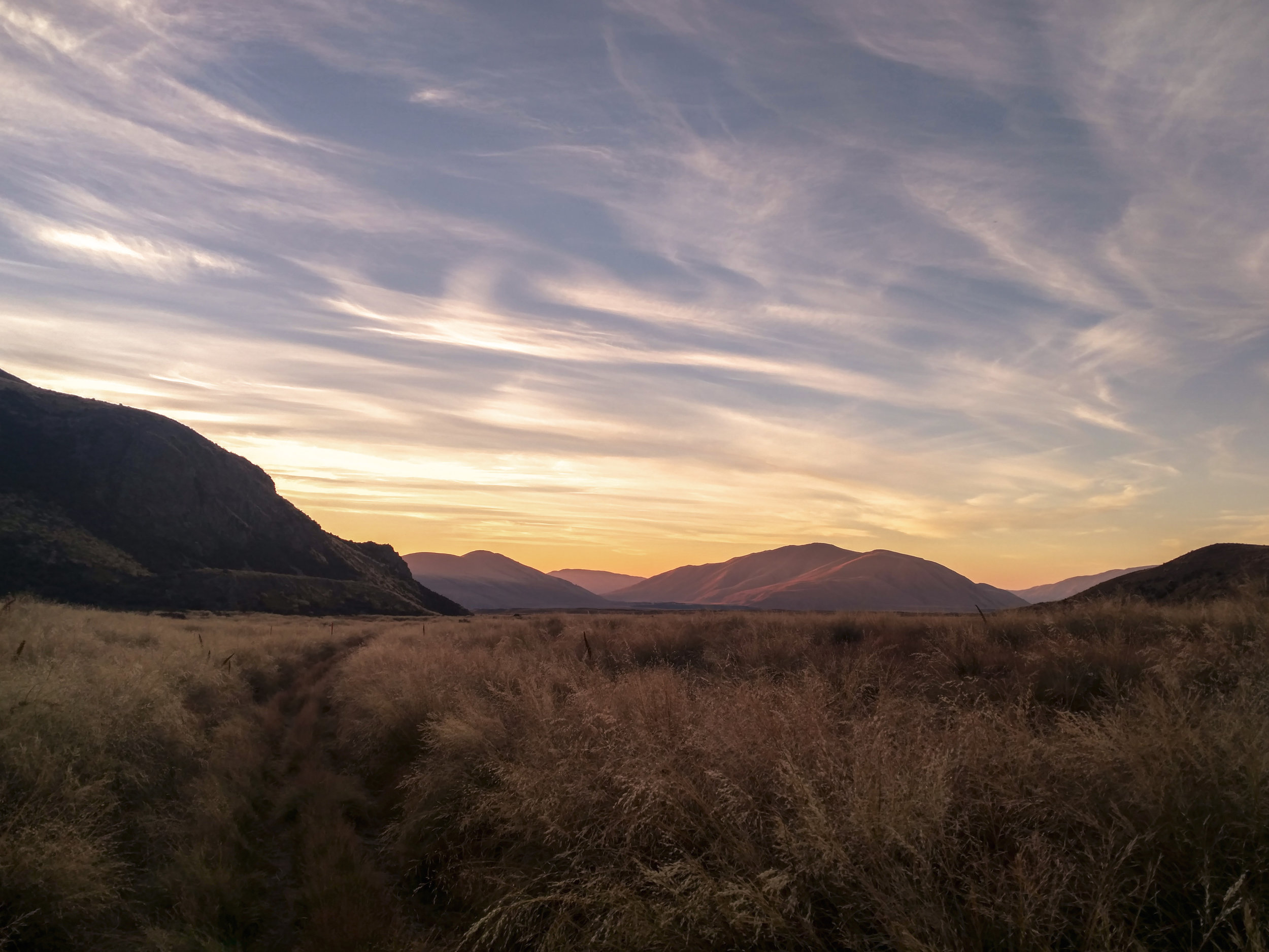
As we approached the Rangitata, Jonathan and I were treated to some stunning views of the stark glacial peaks of the Southern Alps. Descending to the river, we also caught a glimpse of Mount Sunday, the filming location for Edoras in The Lord of the Rings: The Two Towers. The hill itself is actually rather small and unimpressive from a distance, but it sits alone on an island amidst the massive, braided river, and the backdrop is hard to beat. We've been hiking through Rohan!

Mount Sunday (Edoras) is just out of sight in the upper right. It sits down in the middle of that river valley with the snowy peaks towering above it.
photo/ Jonathan
A gloriously shady patch of willows welcomed us to the end of the official trail here, and we sat down to wait for our shuttle.