
The Rangitata: A River Crossing in Many Parts
We had initially planned to take a shuttle around the Rangitata, a large and heavily braided river that the TA Trust officially recommends against crossing on foot. But as we arrived at the shuttle pick-up, three southbound hikers were leaving to walk across anyway. Minutes after they left, a giant Australian man in small shorts and a red-white-and-blue Patagonia hat appeared from the river, heading north. He said the crossing was "super easy," and we chatted for a bit, swapping trail stories and comparing our gear.
The Rangitata is considered dangerous in large part because the valley is massively broad. It takes several hours to get all the way across and the water level can rise rapidly with heavy rainfall (even far upstream, so you may not see this coming). When we arrived, however, it hadn't rained in weeks and the water level was relatively low. With recent beta from someone who'd come across (not to mention several others making the trek ahead of us), we felt confident that we could make it safely to the other side.
After waiting several hours for the shuttle to drop off our food and supplies for the next section, we walked a kilometer upstream to begin our journey across the valley. Once we left the trail on the north side of the river, it would take us three full hours to reach trail again on the southern bank.
As we first waded into the water, we followed a fenceline that took us through several shallower and slower moving channels. Then we ventured out onto a desolate plain of sand and rock. The river itself was manageable — I wouldn't have necessarily used the phrase "super easy,” but I'm 5’6” and not 6’5”, so our friend may not have been entirely disingenuous. However, the defining feature of our crossing was not the water, but the extremely high wind, which had grown worse and worse as the evening wore on. It raged down the valley, pelting us with dust and sand, and we fought to stand up straight as gust after gust swept past. I put on my sunglasses and hid my face in my bandana, but my eyes still stung with the sand whipping in from every angle. My lips were encrusted with silt and all I could hear was the rushing wind and water.

photo/ Jonathan
From within, the Rangitata Valley seemed interminable and at several points, otherworldly. Midway through the crossing, we found ourselves trekking across a grassy field when I realized that we were traversing a sizable rabbit kingdom. The ground was a network of tunnels and (quite treacherous) holes, and little brown rabbits fled from us with every step. But we were surrounded by water… I had so many questions: Can rabbits swim? How did they get here in the first place? How could they possibly survive when the river floods?! Jonathan and I communicated all of these critical questions using hand signals and head shaking -- the roar of the wind made it impossible to hear a word, even standing at an arm's length.

Traversing the Rangitata moonscape in gale force winds.
photo/ Jonathan
The weirdest moment by far came as we walked across a gravel field just like the one in the photo above. Check out the ground under my feet in that picture.
Looks like your average ground, right?
All of my (many, I might note) years of trekking experience had taught me that when I step on ground like this, it feels like, well… solid ground. You can imagine my surprise, then, when I took a completely normal step on this completely normal ground and the rocks under my feet rippled like there was a hole in the space-time continuum.
Quicksand!
My foot began to sink rapidly into the gravel pudding where the ground had been, moments before. And for a second, my whole world was off balance. Then, as I wrapped my brain around my predicament, I swung my body around and crawled back to solid ground with my poles out in front of me as an anchor. Continuing across the rest of the gravel-scape, it it was tough to shake the feeling that not everything was as it seemed.
In total, we crossed about 13 different channels with wide variations in depth and flow. Most were just knee deep, though one fast-flowing stream hit me at the hip and nearly carried me off as we made our way through it. As we reached our last channel, we yelled victoriously and stomped our way to the relative shelter of a small farm road. We sat down briefly and emptied out the mountain of gravel that had made its way in through the holes in our well-worn shoes before beginning the trek downstream to meet back up with the trail.
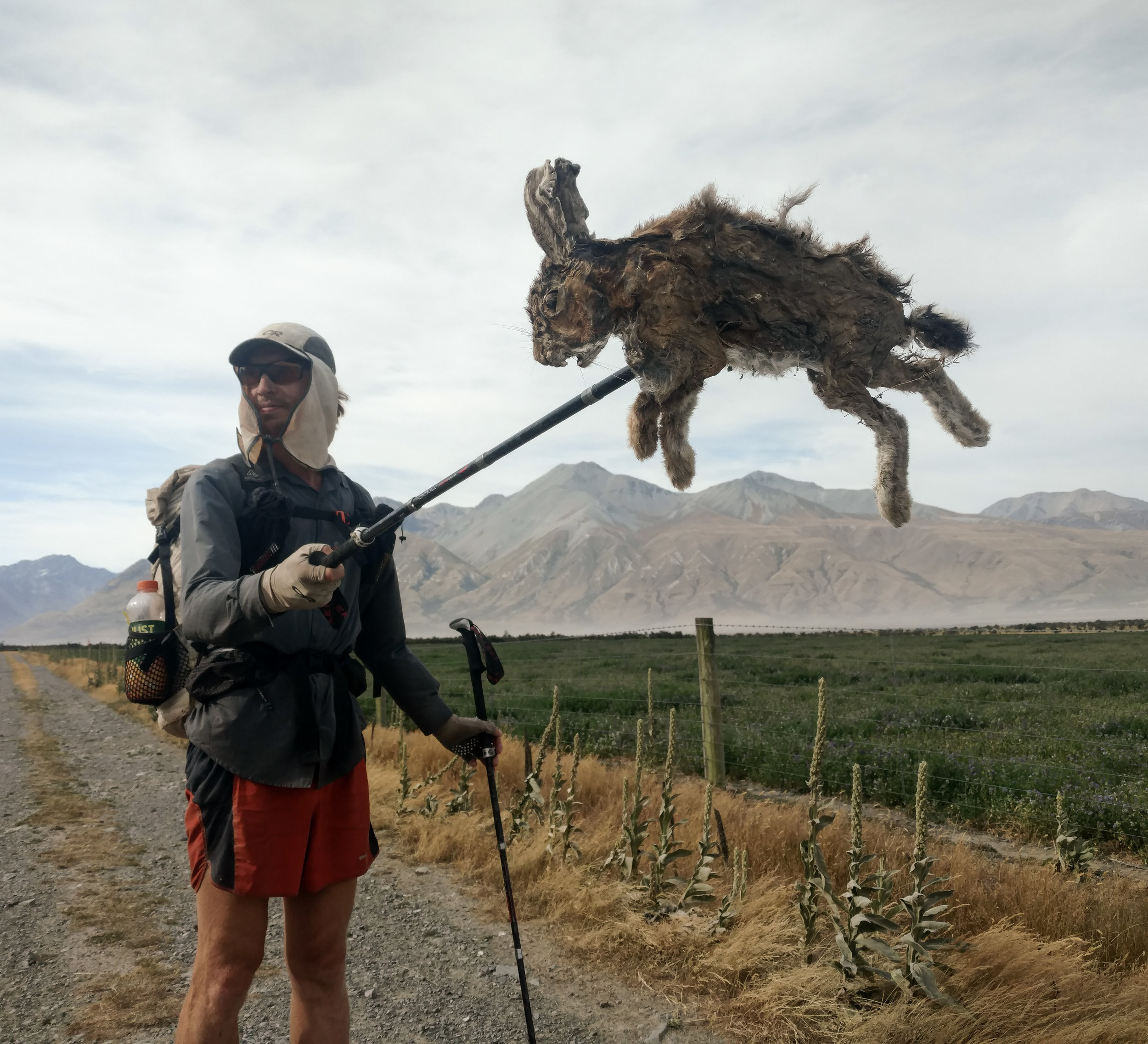
One of the less fortunate rabbits we found on the far side of the river while walking the road back to trail.
photo/ Molly

Looking back across the river valley as we settled into camp.
photo/ Molly
We set up our tent in the most sheltered spot we could find, but there wasn't much sleep to be had. It was strangely warm even while, as we later found out, wind speeds in the valley reached 120 kilometers per hour (~70mph). All night, the sky was an unsettling, luminous orange, but it was dark in the tent, which shook and flapped with every gust.
Jonathan and I both laid awake all night, looking up at the thin fabric, and desperately hoping that our only shelter would survive the night. Toward morning, we heard a snap and one side of the tent broke free. Already wide awake, I lunged out to tie it down again. Luckily, a small clip was the only casualty of the night. But as the sun began to rise, we were both more than ready to pack up our bags. The dusty sky burned in wild shades of coral and hot pink as we hiked up and away from the Rangitata valley.

A night of stress and anxiety gave way to one of the most dramatic sunrises I've ever witnessed.
photo/ Jonathan