
Scrambled Legs
Welcome back, dearest readers. It’s been a very long time since we used this platform to write about our adventures. Our most recent adventure, however, felt like a good time to share some photos of one of the most grand outings we have experienced in quite a while. We traveled to the San Juans, the most remote mountain range in Colorado. Specifically, we went the Weminuche Wilderness and hiked up into Vestal Basin. There stand five peaks that go at nothing easier than fourth class. It was to be a proper alpine scrambling effort!
The first day we drove the many hours to Molas Pass and hiked the 10 miles up to Vestal Basin, where we set up our camp. The next morning we started bright and early with our first mission: the Trinity Traverse. This traverse has some mandatory fifth class moves, but more than the technical difficulty is the degree to which you have to manage very loose, steep rock. These mountains are gorgeous, but I’ll be honest, they are kinda shitpile-y.
Stats for the Vestal Basin Approach
10.5 miles from the Molas Lake Trailhead to Vestal Basin (Lower Camp) via the Colorado Trail & the Elk Creek Trail
3100 feet of elevation gain from car to camp
3 different types of wild berries consumed: strawberries, raspberries, and grouseberries (alpine wild blueberries)!
Stats for the Trinity Traverse
3 stunning summit views
6.16 miles round trip
3500 feet of elevation gain
100000 smol rocks sliding around under our feets
0 (!!) other humans encountered en route

The Trinities! And Molly! From left to right they are East Trinity, Middle Trinity, and West Trinity.

First up, West Trinity. Just look at all those loose blocks waiting to be pulled out.

Hours later, finally descending off of East Shitpile, er, Trinity. Don’t slip. You’ll probably bounce a lot on the way down.

We did it! Trinity Traverse, accomplished. That’s West Trinity behind Trinity Late, with tomorrow’s mission looming in the background.

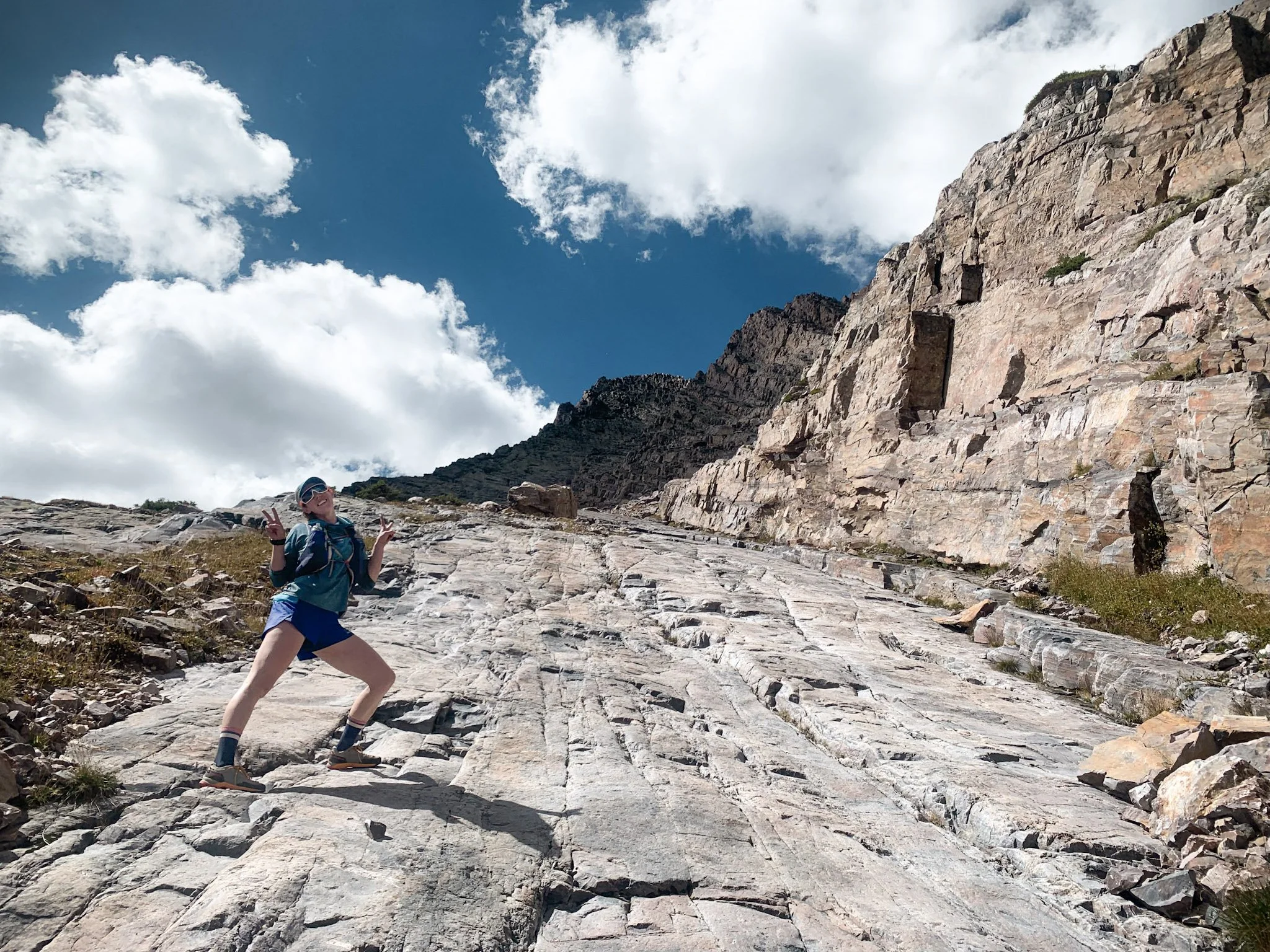
Post-traverse frolicking. Hooray for our first successful alpine scramble of the trip!
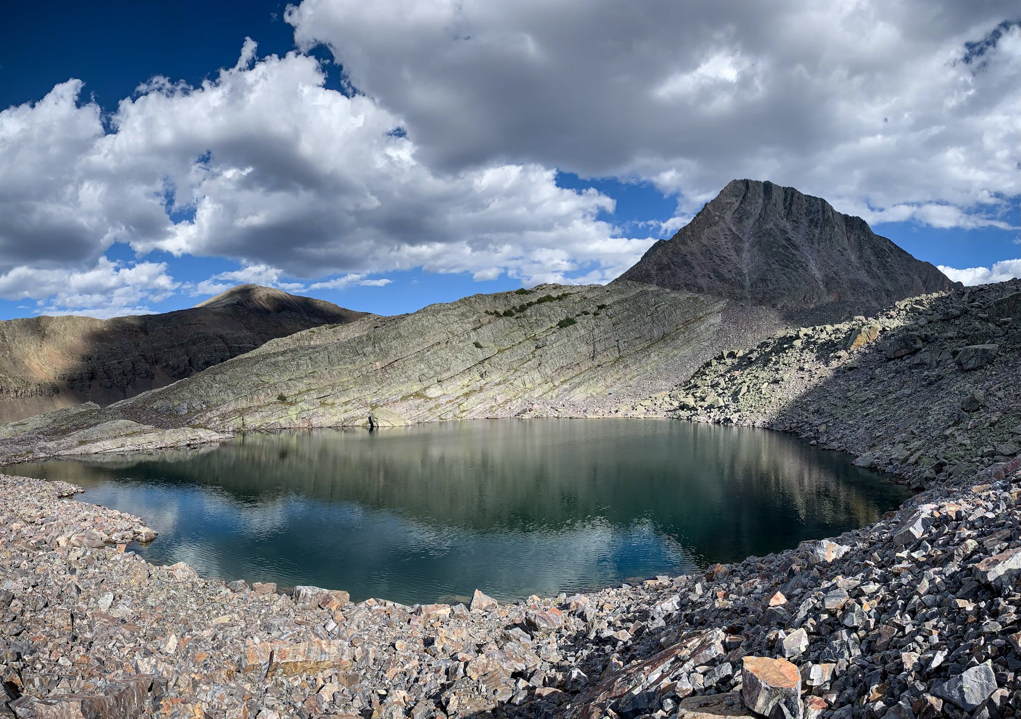
Before we move forward with the peak bagging, miles counting, and vert ascending, let’s take a moment to take a look at Vestal Lake with West Trinity in the background. Goddamn, nature is pretty!
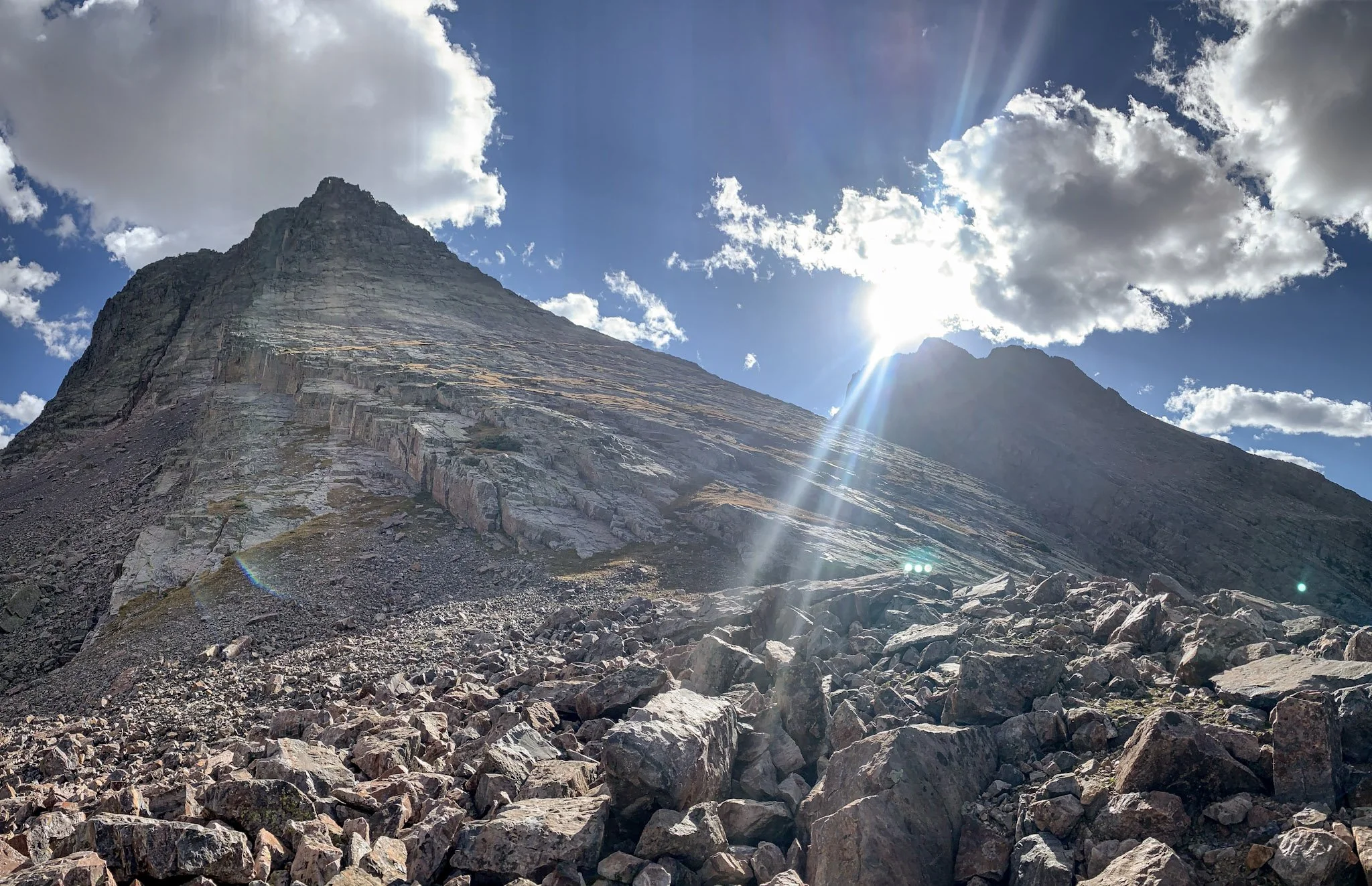
Day two in Vestal Basin, we turned our attention to the main attractions: Vestal and Arrow Peaks. Wham Ridge, which is really the north face of Vestal, is a pretty iconic alpine climb in Colorado. With a grade of 5.4, it is an “easy” climb, while still falling solidly in the realm of technical alpinism. THAT’S MY FREAKIN JAM.
The way down from Vestal, however, sucked. And I don’t just mean a little. I had read lots of trip reports about how bad the descent off of Vestal peak was. It was still fully worth it (see epic photos below), but truly, no photo can capture the sand-sliding, baseball-sized-rock-rolling, semi-technical-downclimbing-on-loose-bullshit descent.
After Wham Ridge, we turned to the last mountain of Vestal Basin: Arrow Peak. At 5.0, this was honestly the best peak as a whole. The climbing, while not quite as magnificent as Vestal, was super fun, and the way down was surprisingly fun as well.
Stats for Vestal and Arrow
4.41 miles roundtrip
4140 feet of elevation gain
Infinite joy in moving around on rocks
More pretty nature: Vestal Peak (left) and Arrow Peak (right)

And so, on the morning of the third day, we did the damn things. Vestal on the left and Arrow on the right. Molly still makes her presence felt too.

My stoke to climb Wham Ridge is just so high! I know I’ve thrown a lot of names at you in this blog post. If you remember one name from this, it should be Wham Ridge. I mean, just look at that thing!

Let’s scramble!

Molly, about 3/4 of the way up Wham Ridge. It was exactly as much fun (on the way up) as I hoped it would be.

Summit of Vestal Peak after topping out Wham Ridge. Very proud moment for us. We just haven’t yet seen the nightmare that is our descent route.
Last mountain of Vestal Basin: Arrow Peak. Just look at Molly. She is so ready to climb up this ramp.

Obligatory summit selfie on top of Arrow. I know, we’re the cutest.

Turns out, the views from the top are pretty mind boggling. The mountains in this part of Colorado go on and on and on.
The weather was perfect. There were practically no other people in the basin, nor on routes with us. We both felt strong. We supported each other as alpine adventure partners. We accomplished all that we came here to do, and we did it safely. I couldn’t be happier with how this section of the trip turned out.
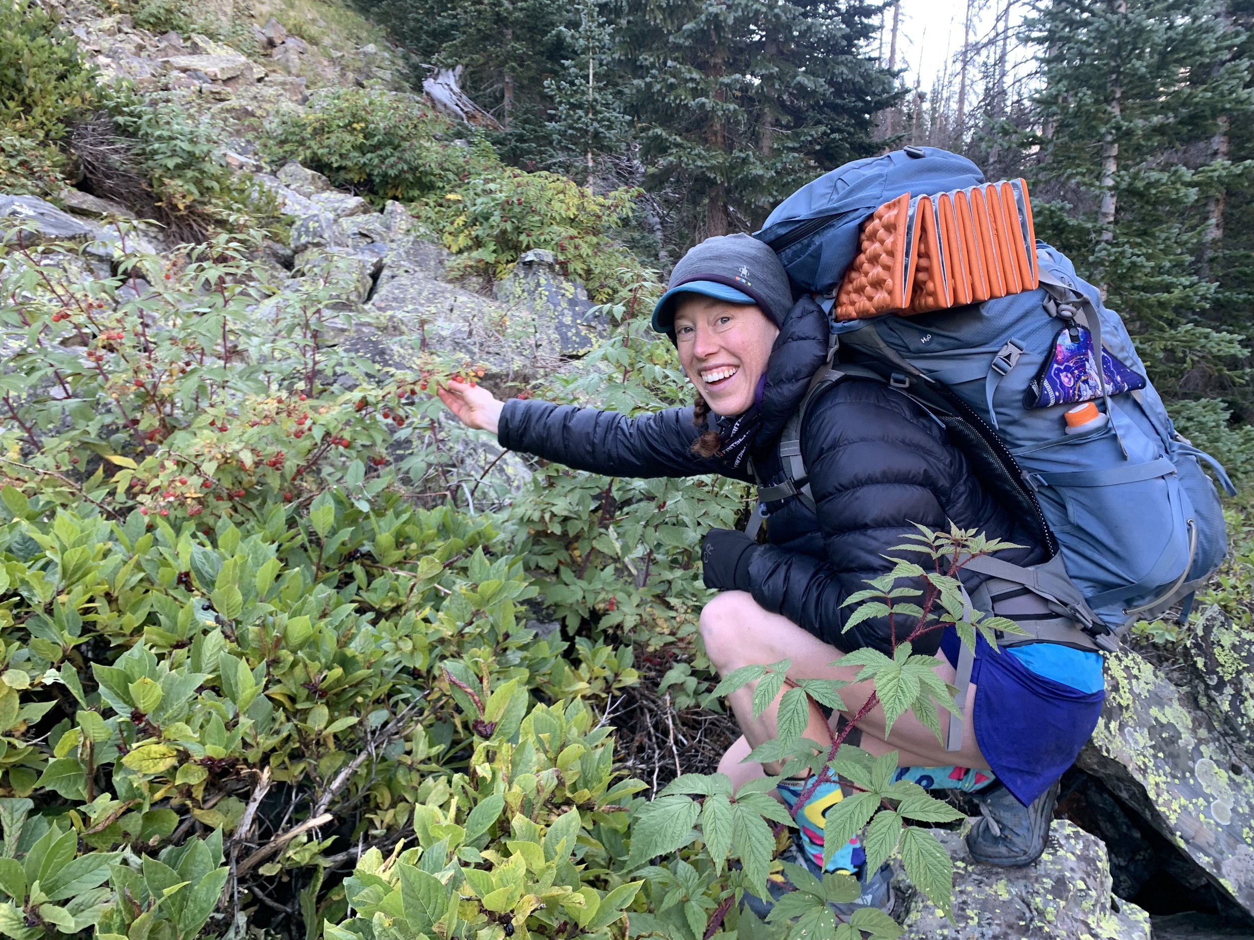
We stopped many times on our hike out of Vestal Basin to eat many raspberries, which brought us many happinesses.
The next day we hiked the 10 miles back to our car, checked out the tiny mountain town of Silverton, and drove to Ouray, where we camped for our next day’s mission: Mt. Sneffels. While all of our previous summits had been 13ers, we figured we might as well tack on a couple 14ers to the end of this trip. To keep the ethic of alpine scrambling alive, we took the third class route up Sneffels. Since we were solidly into the Labor Day weekend, this mountain was packed. Also, it has a similar level of chossiness as the Trinities. We didn’t really take any photos. Oh well. You’ll have to believe me that it was still fun.
For our last day of the trip we figured we would tack on one final scramble: Torrey’s Peak via Kelso Ridge. We’ve each done Torrey’s a few times, but it was our first time up Kelso Ridge, which is also third class. OMG it was incredible. Great ridge climb. 10/10. Would recommend.

Molly! Kelso Ridge!

The knife’s edge. I loved this part. Great rock. Great stance. Fun moves.

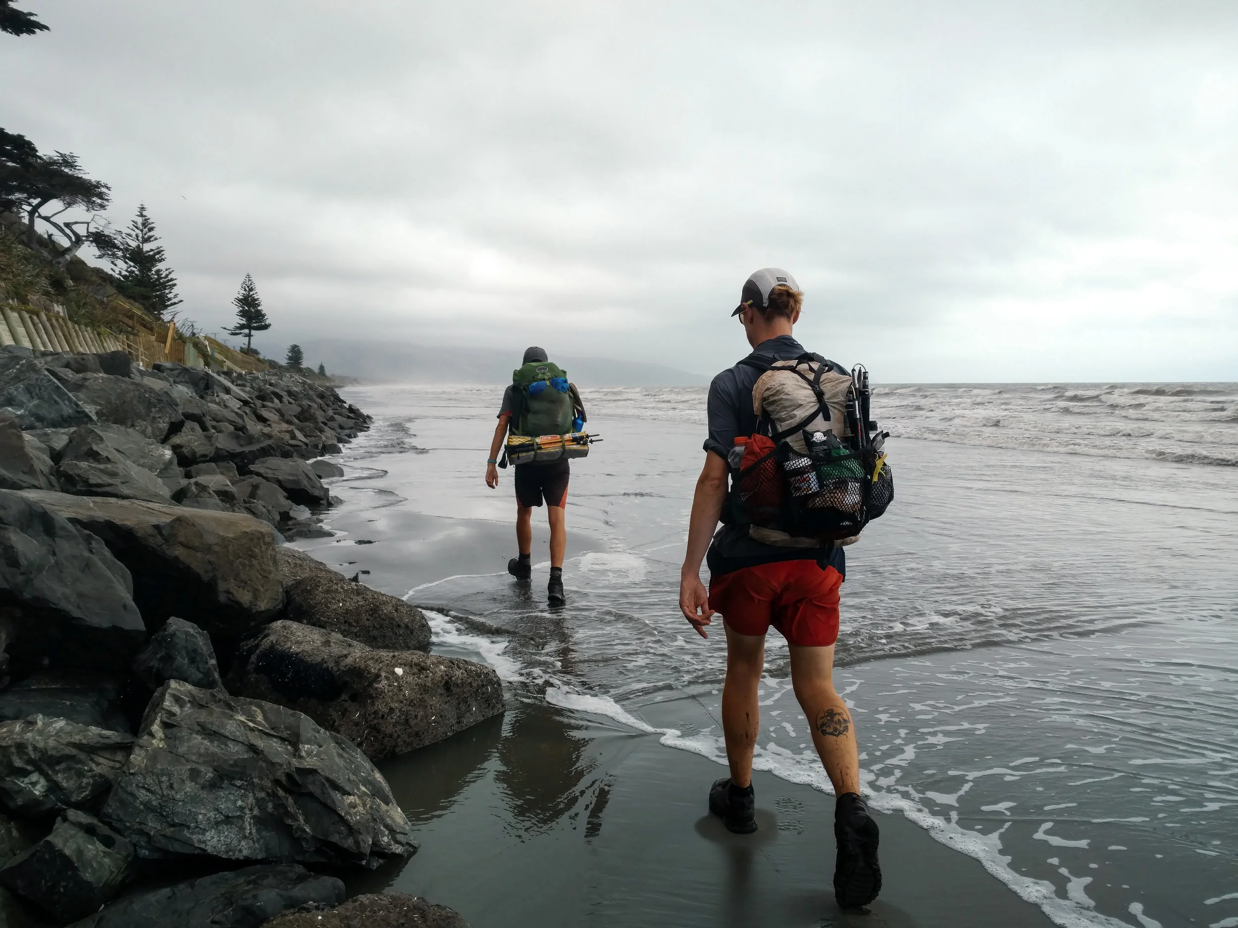
On a rainy day in Bluff
3,000 kilometers of hiking has to end somewhere.
In spite of the dramatic differences in terrain between New Zealand's North and South Islands, there is a strange symmetry to Te Araroa. Entering Southland, it’s not far to the edge of Longwood Forest, mirroring the dense mud of Ratea and Pirongia. Further south, the trail drops down to the southern coast, where it undulates between sheep pastures high on the cliffs and the rocky beaches below. There is even a long, open beach to remind hikers of their first days on Northland’s 90 Mile Beach (luckily, we survived this one without a hailstorm). A stretch of urban wasteland and some good old-fashioned highway walking complete the deja vu, bringing back nightmares from Mercer and Huntly.
Needless to say, Southland was not our favorite stretch of the trail. There were, however, still some moments of beauty in these final miles.
Leaving Te Anau, Southland gave us a lovely day of forest walking, interspersed with massive tussock fields where the grass was often well over my head.

Saying goodbye to the mountains from Princhester Hut near Te Anau
photo/ Molly

Tussock that goes on forever
photo/ Jonathan
Eventually, the tussock gave way to the plushest, lushest carpet of peat bog squishing underfoot. It was wet and a bit oily, but altogether pleasing to walk on (I’m not totally sure why the water is oily in these bogs, but a quick search suggests that it could be a result of anaerobic microbes releasing methane. If you know more, please write a comment and explain more!).

Miles of oily peat bog squishing underfoot
photo/ Jonathan
From the bog, we climbed a steep trail shaded by leafy beech trees to find a perfect rainbow framing the ridgeline behind us. A storm was coming in fast from the south, but we took a moment to enjoy our last high point before beginning our gradual descent toward the ocean.

A rainbow before the storm
photo/ Jonathan

Taking in our last moments up high
photo/ Jonathan
Longwood forest was also much prettier than was advertised by the hikers heading north (I believe one of them referred to it as a “muddy wreckage”). Of course, those lil' baby northbounders had yet to encounter the slip-n'-slide down Pirongia, so I suppose we'll have to forgive them. I won’t say it was bone dry, but really, most of the forest was quite charming.

Ok, not this part. This part wasn't that charming.
photo/ Molly
Deep in Longwood, we even stumbled upon some amazing trail magic from another hiker, Blair, who had carried a full cooler of goodies up to an old hut. We caught him refilling the cooler, so naturally, we sat down to share a cold beer and swap trail stories, as hikers are wont to do. Blair was preparing for the PCT, so we reminisced about good times while offering up some advice (mostly concerning town food and which buffets to avoid most strenuously).
The most beautiful and most surreal moment of our final days on the trail occurred during the last sunrise of the trip. Ready to reach the end, we woke up at 2:30am to catch low tide on the 15 mile long Oreti Beach Track from Riverton to Invercargill. For hours, we walked along the wide, flat sand in near-complete darkness. Then, just as the first flush of magenta appeared on the horizon, a string of strange creatures appeared along the shoreline. We squinted, but couldn’t figure out what it was that was advancing so quickly toward us. Slowly, we began to hear the pounding of hooves and before we really knew what was happening, three horse-drawn chariots flew past us, racing down the beach.

Look very closely and you can see a horse and chariot just below the street lamp.
photo/ Jonathan
For better or for worse, the rest of that final day was about as lackluster as they come. We shared suburban sidewalks with a hoard of school children and then passed through a torrid estuary, followed by the scenic Invercargill wastewater treatment plant. It was raining as we turned onto Highway 1. their abundant wisdom, the Te Araroa Trust decided that instead of ending the trail at the ocean, hikers needed to experience the infinite joys of New Zealand's largest shipping route. After the highway, the epic journey ended with a very wet road walk into the weird little town of Bluff.

Good thing we didn't miss the industrial district!
photo/ Jonathan
In the pouring rain, the end of our adventure was almost comically anticlimactic. And to be honest, neither of us cared very much.
I think the end of a thruhike is always a bit of a funny thing, because it's never the best part of the trip. If it is, I suspect you're doing something wrong. But this trail in particular has an ending that feels like a senior slump. No epic summit on Mt. Katahdin, no clear-cut border into the Canadian wilderness. Just a strange little monument in a strange little town that most people only go through to get to somewhere else.
No, we preferred to think back on the highlights of our trip: the moonscapes of Tongariro National Park and our spectacular summit day on Taranaki, the first views of the Southern Alps from the gorgeous Richmond Ranges and watching wild horses run in Nelson Lakes. In 95 days, we mountain biked through Rotorua, canoed the Whanganui River, and climbed up a waterfall (or several) on our way to Arthur's Pass. We also met some ridiculously amazing people who helped us along the way.

Thank you so much to everyone who has followed along on the weird, wild ride that has been Te Araroa. And an extra special thanks to all of our magnificent friends spread across New Zealand: our journey would not have been the same without you.
If there's anything you'd like to hear more about from our trip or if you have questions about the TA in general, let us know in the comments or shoot us an email (captainsofus@gmail.com). We're taking a little break from blogging, now, while we're beginning some new adventures, but we promise that we'll be back soon with more stories and photos from New Zealand and beyond.
Happy trails,
Molly and Jonathan

Walks, Great and Tussocky
When you have the opportunity to take a 20-mile detour on one of the most lauded trails in all of New Zealand, you take the damn detour.
We climbed out of the car at the Routeburn trailhead and thanked our drivers, a chatty American couple who'd been living in New Zealand for several years. The first thing we saw was a pair of keas picking at someone's windshield wipers and rooting through the bag of trash they had left under their car (If you missed our post about Arthur's Pass, keas are the world's only alpine parrot.) They're incredibly mischievous, highly intelligent, and they love to tear shit apart. Also, trash. They love trash. Think of them as the smaller and (only slightly) less fearsome cousins of those bears in the Adirondacks that learned how to open bear cannisters.

This print we saw from Glenn Jones Art pretty much sums it up.
Actually, there were quite a few parallels between Routeburn and the busiest national parks in the US. This was our first Great Walk of the South Island and it was packed. The trail was at an easy grade and was ultra well-maintained, so we picked up some speed and proceeded to pass -- best guess -- 150 people in the first 10 kilometers (~6 miles). Could have been more.
Several of the groups we passed were being "guided" along the trail, which has basically no offshoots, idiot-proof signage, and huts with rangers every 4 miles. Oh, and 150 PEOPLE walking in a giant line. There's even a full-on hotel, Yosemite Valley style, which is 5 miles from the trailhead and which provides food and bedding so you don't need to carry your own.
Routeburn is one of the most famous Great Walks, so the huts and camping along the route are insanely expensive (it's around $100 US for a hut and $50 per person to camp). That was a little, shall we say, out of our budget. Luckily, the whole of Routeburn is only 32 kilometers (~20 miles), so we just planned to knock out the whole thing that day and sleep in a hut along the Greenstone Track where our hut passes were valid.
We started hiking around 10am and despite the morning crowds, the scenery did not disappoint. We even got to stop at some fancy huts where we could pick up clean water and take breaks away from the sandflies, as needed. We also got a quick glimpse of why the lodging is so expensive: there are vault toilets all along the trail and they fly the vaults in and out with helicopters. A+ for LNT-friendly shitters (Leave No Trace).

photo/ Jonathan

photo/ Molly
We hit the highpoint of the trail just in time to get a view before thick clouds began rolling in.

photo/ Jonathan
Apparently, there is beautiful scenery off the back side of the track, but we didn't see much of it. We waited around for a while near the high point to see if the rain would pass, but a steady drizzle set in and we decided that it was time to move on. It was still a lovely walk down toward Greenstone and as a bonus, the crowds thinned dramatically. By 3pm or so, everyone else had apparently called it a day and we nearly had the trail to ourselves outside of a few stragglers near the huts.

One good thing about rain? Waterfalls! Earland Falls is a 574 foot waterfall that drops right onto the path. Super epic feature of this trail!
photo/ Jonathan
We got a few peek-a-boo views as we descended toward the last hut, then got a spectacular sunset over the Greenstone valley. Our hut for the night was a beauty with flush toilets and all. Flash as! (That's kiwi for "swank af" or -- for old people -- "extra fancy.")

McKellar hut was a welcome sight as dusk approached.
photo/ Molly
The Greenstone Track, which we followed back to the official Te Araroa route, was simply lovely. The walking was easy, the weather was perfect, and we hardly saw another person (just a ranger out there checking hut passes). We wandered through pastureland and cruised along soft forest paths.

Walking down the Greenstone Valley
photo/ Jonathan
Back on the TA, we trekked through more beautiful forest, with a couple of gorgeous views back toward Routeburn. Then we walked until reaching Jonathan's very favorite part of the trail: miles and miles and miles (and miles) of swampy, slippery tussock. Sometimes, there was a trail. More often, we followed vague traces of previous hikers through the dense ground cover, constantly losing the trail because the markers were buried in the grass.

Crawling under barbed wire fences is a totally normal part of trail, right? Oddly enough, this one had its own waypoint in our guide app.
photo/ Jonathan
The last day into Te Anau turned out to be a very, very wet one. We woke up early and got a good 20 kilometers (~12 miles) in before we felt the first drops, but the storm caught up to us as we walked the gravel road toward Te Anau. We donned warm hats, gloves, wool shirts, and full rain suits, and picked up our pace, trying to stay warm as the wind slashed cold rain directly into our faces.

A storm is coming, but why is the sky pink?! (Early morning, facing northwest).
photo/ Jonathan

Trying to beat the storm. Spoilers, we didn't.
photo/ Jonathan
We graciously accepted a ride from a kind passerby and rode the last 10 kilometers in style, sitting in the back of a work van on a big plastic tub, surrounded by tools and bits of wire. Though he had only offered a ride to the highway, the driver took pity on us and instead of leaving us at the end of the gravel to hitch in the rain, he brought us along with him into town. We made a beeline to the nearest cafe and dripped our way to a cozy seat and a hot beverage.

Left at Motatapu, then straight on 'til Queenstown
When you're in a touristy mountain town like Queenstown, why not try "the best burger in the world" and go skydiving.
Queenstown is New Zealand's "adventure capital," where you can bungee jump, climb into a giant zorb, take a luge ride, or parasail over Lake Wakatipu. Of course, it is overrun with tourists from all over the world. To get there from Wanaka, we hiked the Motatupu Track to an abandoned mining settlement called Macetown, then walked a full day through sprawling suburbs to reach the city center. Queenstown was, by far, the largest ‘trail town' on the South Island.
Motatapu was a beautiful trail, if short (less than 25 miles). It was filled with sharp ridgelines covered in golden tussock, and though it was hot, we were rewarded at the top of each climb with a breeze and a glorious view over the rippling valleys. The section ended with a river walk through a perfectly clear stream complete with burbling waterfalls and colorful underwater rock formations.
Heading up the Motatapu Track out of Wanaka.
photo/ Jonathan

photo/ Jonathan

So much texture!
photo/ Jonathan
Macetown might have been slightly eerie had we not passed through on a weekend when giant car-camping tents were tucked into every patch of trees. We hopped on the 4WD road down to Arrowtown and joined in the weekend spirit by free camping along the side of the road.
Arrowtown marks the beginning of the Queenstown suburbs. From there, we followed wide gravel bike trails through golf courses and gated communities, then turned onto side roads which turned into highways. We even visited the oh-so-scenic Frankton water treatment plant. Lucky us.

You know town is near when the trail turns into a gravel bike path.
photo/ Jonathan
Joking aside, though, we did get some pretty rad views from the road. The Remarkables towered to the east and the city itself is nestled along the western banks of Lake Wakatipu. The walk into Queenstown was greatly improved by a quick stop for pies at Pac 'n Save (basically, the Costco of New Zealand) and by the perfectly located Altitude Brewing taproom.

The Remarkables towering above Lake Wakatipu
photo/ Jonathan

Lake Wakatipu, Queenstown, and the neighboring mountains
photo/ Jonathan
Once we made it to the city center, our first stop was, naturally, more food. We hopped in line to try out the "best burger in the world" at Fergburger. Obviously, we also stayed for gelato at Mrs. Ferg, next door.

Fergburger: a tale of love at first bite.
photo/ Jonathan

Such a juicy, delicious burger. Not sure I'd agree with the "best in the world" designation, but it didn't suck.
photo/ Jonathan
Lake Wakatipu forms the last big break in the trail, and hikers generally have to hitchhike around the lake from Queenstown to Glenorchy. Instead of taking the standard Te Araroa route, Jonathan and I planned to hike the Routeburn Track (another one of New Zealand's Great Walks) and then reconnect to the main trail via the Greenstone valley. We'd still have to hitch the road, but the added miles promised to deliver some extra oomph.
For me, the unquestionable highlight of our time in the Queenstown area was getting to skydive for the first time. Charlie and I signed up for a jump from Glenorchy so that we could look out over the Routeburn Track, where we'd be hiking the next day, as well as the massive glaciers of Mount Earnslaw and Mt. Aspiring National Park.
I can see why people get addicted to that feeling of freefall, but my favorite moment by far was when the chute opened and the world fell totally silent. The lake seemed impossibly far below. I peered down into the green valley of the Routeburn with the ice blue Earnslaw glacier dominating the skyline to the west. Little green pastures lined the lake below, and as we did some wide swooping turns, I could see the little merino sheep dotting the landscape.

After landing, I ran to grab my phone so I could get a few snaps of Charlie coming down after me.
photo/ Molly

Charlie comes in for the landing.
photo/ Molly
As we hitchhiked up to the start of Routeburn, we were starting to feel like the end was near.

Five Lakes and Two Wheels
Jonathan and Molly trade in their two feet for two wheels, then take a tour of New Zealand's alpine lakes.
Lake Tekapo marks the beginning of a long stretch of lake hopping from Tekapo to Lake Pukaki, then Lakes Ohau, Wanaka, Hawea, and finally Lake Wakatipu in Queenstown. All of these lakes are massive, gorgeously blue alpine beauties set below the Southern Alps.
The first leg of this journey, from Tekapo to Twizel, follows a gravel cycle trail along a series of canals. It's flat, exposed, and though there are stunning views, they don't change much for about 35 miles. To liven up the flats, we opted for two wheels instead of two feet.
Our bikes arrived at 8:30am and we rode off feeling gleefully free of our packs, which were being shuttled directly to Twizel.

photo/ Molly
About halfway through our ride, we soared down a long, smooth descent toward the stunning Lake Pukaki and joined a gravel cycle trail along the lakeshore. The glaciers of Mount Cook National Park beckoned in the background. Of course, we couldn't resist a quick stop at the Salmon Shop at the south end of Lake Pukaki, which offers up local New Zealand king salmon sashimi.

photo/ Jonathan

photo/ Molly
A note for hikers/travelers interested in doing this ride: We used BeSpoke Bike Tours, which I can highly recommend. It ran us $65 NZD per person with a group of 3+ and the super friendly owner, Annie, shuttled our packs to Twizel and met us at the end. The bikes arrived with full water bottles and small packs where we could store sunscreen and a few snacks for the ride. The trail is mainly gravel with a bit of paved road and is suitable for anyone relatively fit, even with no mountain biking experience at all.
The next two days were filled with big climbs and beautiful views. After walking around Lake Ohau, we headed up through blissfully shady beech forest to an unnamed pass where, miles and miles from any town, we found a small spring gushing out of the mountainside. Someone had planted a pole next to it with two small hooks holding little copper mugs for passing trampers to sample some pure NZ spring water. There wasn't a sign and it would have been easy to miss, but the little act of camaraderie made me smile. Of course, we stopped for a sip.

Dawn vibes in the valley
photo/ Jonathan
Charlie takes in the view on the climp to Martha saddle.
photo/ Jonathan
We had two more substantial climbs to surmount before Lake Hawea and they couldn't have been more different. The steady grind to Martha Saddle was tussocky with jagged ridges rising towering above a wide, rocky 4WD track. But the climb to Breast Hill was steep and scrappy; we hauled ourselves up steep walls of soil on roots and trees, kicking steps into the dirt. Just as we reached the summit of Breast Hill, the clouds began to thin and we glimpsed a fleeting view of the lake before descending the wild, jagged ridgeline toward the water. We'd been wondering where all of New Zealand's switchbacks had been hiding, but as we zig-zagged down interminable 100-foot-long runways, we wondered no longer.

photo/ Jonathan

Descending the steep ridges off of Breast Hill.
photo/ Jonathan
From Lake Hawea, the trail follows roads and bike trails leading directly into Wanaka. Wanaka is a small ski town that has grown substantially in recent years, but retains a core of van dwellers and adventurous types who staff the many cafes, gear shops, and kayak rental kiosks along the beach. It sits in a little cove at the southern end of another perfect mountain lake. We stayed at a cozy "backpackers" (hostel) with a communal kitchen that was constantly filled with people chattering in French, Dutch, and German. It had a big grassy yard with picnic tables and laundry drying on the lines.
For hikers: This is a must-stay hostel -- definitely our favorite one in New Zealand -- but you may need to book ahead from Twizel or Lake Hawea. Check it out here.
Wanaka would be our first zero day on the South Island and it truly was everything we dreamed it could be. The day started out with a jog along the beach to visit #thatwanakatree at dawn.

Don't let the tranquil image fool you; this little tree is an international Instagram star.
photo/ Jonathan

Perfect morning light on the shores of Lake Wanaka
photo/ Jonathan
After breakfast, Jonathan, Charlie, and I rented a set of frisbee golf discs, grabbed a six pack, and headed up to the local course. Charlie and I still managed to enjoy ourselves while getting thoroughly trounced, then Jonathan led us all back to town for victory burritos. Mexican food is (very) rare here and since Kiwis think black pepper is too spicy, decent burritos are pretty much impossible to find. Burrito Craft did not disappoint. Two Americans were working at the counter and the spice scale ranged from 0-10 with severe warnings on everything above a 5.
For dinner that evening, we hit up a trendy spot on the waterfront that was so jam-packed that the three of us (as the hikertrash that we are) just decided to take our plates outside and sit on the sidewalk, rather than waiting for a table or standing awkwardly in the corner. We got a good laugh as an older woman, clearly a tourist from China, stopped to openly take a photo of us sitting cross-legged with our plates in our laps. It made us feel a bit like zoo animals, but at the end of the day, my only regret is that I didn't have the presence of mind to whip out my phone and snap a shot of her, as well.

Molly working on her putting game
photo/ Jonathan

Jonathan absolutely slaughtering the competition
photo/ Molly
Of all of the towns we visited along the trail, none quite captured our hearts as much as Wanaka. It was hard to leave the next morning, though we softened the blow a bit with a third (yea... third) round of the locally made Black Peak Gelato. Kiwis have a weird obsession with "Hokey Pokey" ice cream (vanilla ice cream with chunks of honey comb), but my favorite unique local flavor was definitely the feijoa sorbet. Feijoa is apparently called pineapple guava in the states, though I'd never heard of it before coming here. To me, it tastes a like a delicious tropical version of a granny smith apple mixed with pineapple and papaya.

Blackpeak Gelato has a very special place in our hearts.
photo/ Molly
We walked out of town, ice cream cones in hand, and strolled along the lakeshore admiring the massive peaks of Mt. Aspiring National Park in the distance.

Going Stag
The most tedious day of hiking through wet tussock turns brilliant as we reach Te Araroa's highest point, Stag Saddle.
The wind followed us as we climbed up from the dusty Rangitata valley. The riverwalk was beautiful, though, running through a deep gorge with beech and pine forests lining the edges. As we climbed up the steep, steep ridgeline toward the first hut, the gusts were so strong that we had to stop and crouch on the ground to avoid being blown off the mountain.

Looking back down at the dust storm still raging in the valley below made us glad to be past the Rangitata.
photo/ Molly
We took a break in that first hut, an old one with a metal roof and stone floor. The building shook and rattled around us, but we were glad for the brief respite. The wind began to subside a bit once we left the hut and began the ascent toward the high point of Te Araroa. If there's anything this trail has taught us, its that we should truly appreciate a good quality trail. This was... not that. We slipped and slid through tussock as we marched gradually upward, and it began to rain softly.

This is what tussock hell looks like. Don't see a trail? Neither do we.
photo/ Jonathan
By the time we reached the second hut, rain was pouring down in sheets and we had to hike hard to stay warm. We ducked inside for a somewhat soggy lunch of tuna wraps stuffed with potato chips (hiker health food...). The huts on the South Island can feel luxurious at times like these, offering havens safe from the rain (and sandflies). But sometimes, they also create gathering points for hikers that cause things to get crowded, particularly when it's toughest to leave; the rain always looks worse when you're inside, looking out.
We ventured back out into the wet weather with chilly hands and feet, but as we neared yet another hut, the rain slowed to a drizzle, then rapidly disappeared into a hot, sunny afternoon. A crowd of people, maybe 10 hikers, stood outside of the hut, marveling at the sudden warmth. Scared of the forecasted rain, one group had woken up in the hut and decided not to leave. Others had hiked in from the adjacent huts, one of which was less than 4 miles away. There were 5 more hikers still huddled inside the 6-bunk hut. We'd met the confluence of the SOBOs and NOBOs ("south-" /"northbounders") -- luckily, our 24 mile day meant leaving them behind really, really quickly. We had the trail to ourselves as we hiked the last few miles to the saddle.
The rest of our day was straight up magical. We made the final climb to Stag Saddle, the high point of the official trail, and then headed across a scree field onto a long, open ridge for the smooth, gradual descent to Lake Tekapo, with the snow-topped Southern Alps rising above the water. From the ridge, we got our first clear glimpse of Aoraki (Mt. Cook), the highest peak in New Zealand, with its massive glaciers. We also got our first look at the lake itself, so blue that it looks in real life like an over-edited photo. Running down a ridgeline with a perfect breeze, stunning views, and a smooth trail may just be my favorite feeling in the entire universe.

The incredible view from the ridge adjacent to Stag Saddle. Not only did we get to walk down the glorious trail along this ridge, the view of Lake Tekapo stretched out below us certainly added to the scene.
photo/ Jonathan

A look back to whence we came. We came off the ridge on the left, reaching it via the saddle at the top/center.
photo/ Jonathan

The Rangitata: A River Crossing in Many Parts
A river flows, the wind blows, and onward we hike. A river crossing becomes anxiety inducing, but not for the reason we expected.
We had initially planned to take a shuttle around the Rangitata, a large and heavily braided river that the TA Trust officially recommends against crossing on foot. But as we arrived at the shuttle pick-up, three southbound hikers were leaving to walk across anyway. Minutes after they left, a giant Australian man in small shorts and a red-white-and-blue Patagonia hat appeared from the river, heading north. He said the crossing was "super easy," and we chatted for a bit, swapping trail stories and comparing our gear.
The Rangitata is considered dangerous in large part because the valley is massively broad. It takes several hours to get all the way across and the water level can rise rapidly with heavy rainfall (even far upstream, so you may not see this coming). When we arrived, however, it hadn't rained in weeks and the water level was relatively low. With recent beta from someone who'd come across (not to mention several others making the trek ahead of us), we felt confident that we could make it safely to the other side.
After waiting several hours for the shuttle to drop off our food and supplies for the next section, we walked a kilometer upstream to begin our journey across the valley. Once we left the trail on the north side of the river, it would take us three full hours to reach trail again on the southern bank.
As we first waded into the water, we followed a fenceline that took us through several shallower and slower moving channels. Then we ventured out onto a desolate plain of sand and rock. The river itself was manageable — I wouldn't have necessarily used the phrase "super easy,” but I'm 5’6” and not 6’5”, so our friend may not have been entirely disingenuous. However, the defining feature of our crossing was not the water, but the extremely high wind, which had grown worse and worse as the evening wore on. It raged down the valley, pelting us with dust and sand, and we fought to stand up straight as gust after gust swept past. I put on my sunglasses and hid my face in my bandana, but my eyes still stung with the sand whipping in from every angle. My lips were encrusted with silt and all I could hear was the rushing wind and water.

photo/ Jonathan
From within, the Rangitata Valley seemed interminable and at several points, otherworldly. Midway through the crossing, we found ourselves trekking across a grassy field when I realized that we were traversing a sizable rabbit kingdom. The ground was a network of tunnels and (quite treacherous) holes, and little brown rabbits fled from us with every step. But we were surrounded by water… I had so many questions: Can rabbits swim? How did they get here in the first place? How could they possibly survive when the river floods?! Jonathan and I communicated all of these critical questions using hand signals and head shaking -- the roar of the wind made it impossible to hear a word, even standing at an arm's length.

Traversing the Rangitata moonscape in gale force winds.
photo/ Jonathan
The weirdest moment by far came as we walked across a gravel field just like the one in the photo above. Check out the ground under my feet in that picture.
Looks like your average ground, right?
All of my (many, I might note) years of trekking experience had taught me that when I step on ground like this, it feels like, well… solid ground. You can imagine my surprise, then, when I took a completely normal step on this completely normal ground and the rocks under my feet rippled like there was a hole in the space-time continuum.
Quicksand!
My foot began to sink rapidly into the gravel pudding where the ground had been, moments before. And for a second, my whole world was off balance. Then, as I wrapped my brain around my predicament, I swung my body around and crawled back to solid ground with my poles out in front of me as an anchor. Continuing across the rest of the gravel-scape, it it was tough to shake the feeling that not everything was as it seemed.
In total, we crossed about 13 different channels with wide variations in depth and flow. Most were just knee deep, though one fast-flowing stream hit me at the hip and nearly carried me off as we made our way through it. As we reached our last channel, we yelled victoriously and stomped our way to the relative shelter of a small farm road. We sat down briefly and emptied out the mountain of gravel that had made its way in through the holes in our well-worn shoes before beginning the trek downstream to meet back up with the trail.
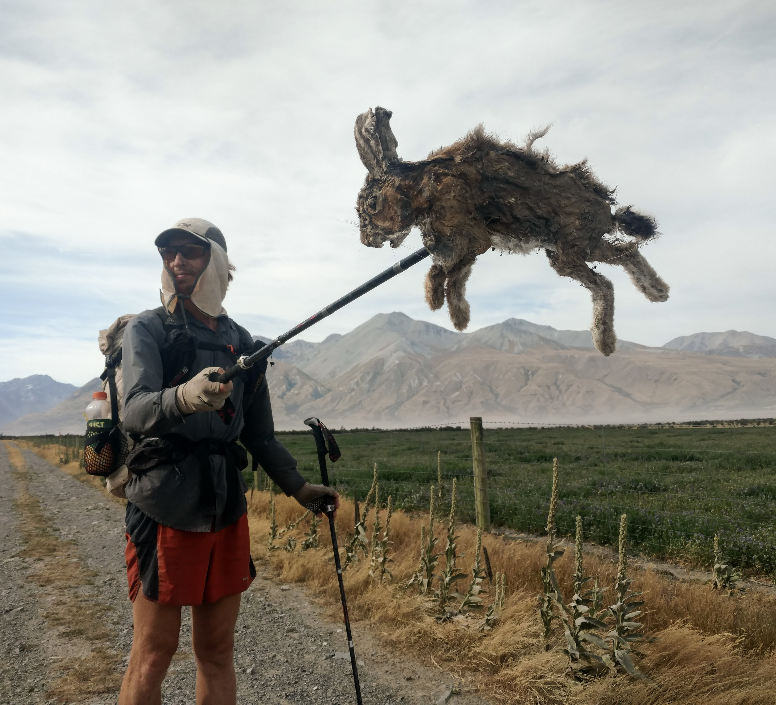
One of the less fortunate rabbits we found on the far side of the river while walking the road back to trail.
photo/ Molly

Looking back across the river valley as we settled into camp.
photo/ Molly
We set up our tent in the most sheltered spot we could find, but there wasn't much sleep to be had. It was strangely warm even while, as we later found out, wind speeds in the valley reached 120 kilometers per hour (~70mph). All night, the sky was an unsettling, luminous orange, but it was dark in the tent, which shook and flapped with every gust.
Jonathan and I both laid awake all night, looking up at the thin fabric, and desperately hoping that our only shelter would survive the night. Toward morning, we heard a snap and one side of the tent broke free. Already wide awake, I lunged out to tie it down again. Luckily, a small clip was the only casualty of the night. But as the sun began to rise, we were both more than ready to pack up our bags. The dusty sky burned in wild shades of coral and hot pink as we hiked up and away from the Rangitata valley.

A night of stress and anxiety gave way to one of the most dramatic sunrises I've ever witnessed.
photo/ Jonathan

Hiking Through Rohan
Tales of reunion, gear coming apart at the seams, and hot, tussocky grasslands.
There are three places on the South Island where the official Te Araroa route is discountinuous. The first is at the Rakaia River, which the TA Association deems too dangerous to cross at any time. The second is at the Rangitata River (crossing is officially unadvised), and the third is at Lake Wakatipu (Queenstown). There's no official route around any of these obstacles, so hikers find all sorts of creative ways to get from point to point.
Jonathan and I hadn't had a shower since St. Arnaud, 8 days earlier, so as we got close to the Rakaia, we welcomed the chance to hitch into Methven for the night. We also knew that after pulling some ultra-long days, we were hot on Charlie's heels -- he'd been ahead of us since Wellington. We had a joyful reunion that was only improved by an all-you-can-eat Thai buffet.
Methven was a brief town stop for us, but a critical one. I'd picked up new shoes back in Whanganui (on the North Island), but those "new shoes" were now a month old and disintegrating. One could say they had lost some structural integrity...

photo/ Molly
The shredded padding inside was beginning to rip apart my feet and had torn majors holes in all of my socks. I wouldn't get new shoes until Wanaka, two towns south, so I picked up some new socks and athletic tape to help protect my feet.
Charlie, Jonathan, and I caught a shuttle out the long gravel road to the south side of the Rakaia, where the trail picked up again. We spent a leisurely afternoon climbing up from the Rakaia valley and spent the night in the adorable 3-bunk A-frame Hut.

photo/ Molly

photo/ Jonathan
The mountains between the two rivers (the Rakaia and the Rangitata) are basically just massive piles of gravel covered with thick fields of tussock. It's rugged and beautiful, but it can seem a bit barren, too, especially without much wildlife other than the occasional rabbit. We started the section on 4-wheel drive track (somewhere between a trail and a dirt road), which made for easy walking. But after a couple of hours, we took a sharp turn and plunged directly into a 5 mile riverwalk.

photo/ Jonathan
Once again, we found ourselves shin deep in fast-flowing icewater as we climbed steadily up toward the saddle. The day was getting hot, though, and the cold water was a bit of a refuge. Every so often, we'd soak our hats and sun covers in the creek and shiver as the droplets ran down our backs. Relief!
Nearing the top of the saddle, a trail began to climb up above the water into the tussocked hillside. The tussock fields can range from 6 inch tufts on bare soil to dense ranks of coarse, chest high grass. In the deeper sections, it's nearly impossible to see your own feet and we constantly tripped ourselves on the surprisingly sturdy strands.
We had to slow our pace to avoid injuring knees and ankles as the ground beneath us dipped and dived, unexpectedly. Though dry, the tussocks were slippery and tiny streams ran through underneath the roots, out of sight. The front hiker would yell out when they found a particularly deep dropoff: "Hole!"
Or sometimes the call would come out: "Cactus!" Between the grasses lies an abundance of sharp, prickly plants that like to scratch and stab at your legs. The worst are giant cactus-like plants called "Spiny Spaniards" (Aciphylla) that have a bouquet of long, stiff, and incredibly sharp leaves clustered around the base and giant yellow spines nestled in between the small flowers that grow up along the thick stem.
At one point, searching for trail markers in the high grasses, we were directed into a forest of these sping beasts where the main stems towered well over Jonathan's head. They were interspersed with some good old matagouri (our standard "thorn forest"), which seemed a bit tame by comparison. By the time we reach real trail again, several hours later, our legs are scraped and bloody. If there's ever a next time on this one, I'm going in with shinguards...

Spiny Spaniard
At lunch, we found a creek where we could ice our battered legs and we managed to stay reasonably cool while we ate, though there was no shade for miles and miles around. We had the whole valley to ourselves, surrounded by mountains in every direction.
Though the trail was easier for the afternoon, the heat was punishing. A large DOC sign at one trail junction offered just enough shade for Charlie, Jonathan, and I to squeeze in and take a break. It was nearly 8pm when we arrived in camp and the first cool breezes were just beginning to cut through the stuffy warm air.
photo/ Molly
As we approached the Rangitata, Jonathan and I were treated to some stunning views of the stark glacial peaks of the Southern Alps. Descending to the river, we also caught a glimpse of Mount Sunday, the filming location for Edoras in The Lord of the Rings: The Two Towers. The hill itself is actually rather small and unimpressive from a distance, but it sits alone on an island amidst the massive, braided river, and the backdrop is hard to beat. We've been hiking through Rohan!

Mount Sunday (Edoras) is just out of sight in the upper right. It sits down in the middle of that river valley with the snowy peaks towering above it.
photo/ Jonathan
A gloriously shady patch of willows welcomed us to the end of the official trail here, and we sat down to wait for our shuttle.

Cross All the Rivers; Eat All the Pies
Well, this was one way to get acquainted with New Zealand's rivers.
We hitched out of Hanmer Springs with our bellies full of fish and chips (and maybe some chicken curry pie, too). The days are long still, and it's light until well after 9pm, so even after arriving back at the trail around 4pm, we still had plenty of time to hike.
The first few miles were dusty and dry (I had a bit of a nosebleed, actually -- it's not all fun and games out here, you know!). This was the last time we'd have dry feet for several days.
We found a beautiful campsite next to the river and had it all to ourselves. The sun was just starting to set as we cooked dinner, and though the sandflies were getting aggressive, we decided to have a scenic meal out on the bank. We're supposed to be enjoying the great outdoors, right?
Well, about three bites in, we both admitted that the sandflies were driving us out of our minds and we sought a less scenic refuge in the tent. Once you defeat the small army of them that followed you into the mesh, the tent provides a decent safety zone. We ate the rest of our mac and cheese in peace; sometimes the outdoors is overrated.

Sunset over the river
photo/ Jonathan

Hiking in the evening sunshine
photo/ Jonathan
Things started to get swampy early the next morning as we hiked along the Hope River and traversed around Lake Sumner. By the afternoon, we'd left the Hope to follow the Hurunui River, where large chunks of the trail had been swept away by a recent flood. Though our elevation profile looked nearly flat, it soon became obvious that the terrain would be far from easygoing.
We moved gingerly through the patches of brush we not-so-lovingly refer to as "thorn forest" -- 6 foot tall hedges with unfriendly inch-long thorns. Then we'd scramble up the steep, slippery bank of the river, edge across a washout, climb down to cross another stream, and repeat the process all over again.

The Hurunui River Valley
photo/ Jonathan

Molly walks the tight rope over a stream
photo/ Jonathan
The 26-mile day ended with a steep climb up toward Harper Pass, where the trail had been completely washed away. We clambered up through a steep, damp forest on a use trail that was falling apart under our weight.
From Harper Pass, Te Araroa follows the Harper River down as it turns from a tiny stream into a major waterway. By this point, there's no semblance of a trail. We look for markers every once in a while, but most of them seem to have washed away in the flooding. It doesn't really matter, though. We still have miles and miles before our route leaves this valley.
At first, we slide our way down piles of fist-sized rocks and leapt back and forth across the river. As the valley broadens, we slowly made our way across fields of gravel, driftwood, and tumbles of river rock. This terrain is tough on the body and it takes a lot of concentration to keep moving. Sometimes, hopping from rock to rock is the only way to avoid the exhausting slog of our feet tipping and sliding with every step.

photo/ Molly

photo/ Jonathan
As the river grows larger, crossing it becomes a more significant affair. At one point, with a large tributary coming in, our GPS line leads down the true right side of the Harper, but some errant markers suggest that we should cross to true left to ford the tributary separately. We make our best guess and follow the markers.
The Harper is well over knee deep by this point, but the flow is manageable and we make it across without too much trouble. The tributary, however, is flowing fast and part of the channel is thigh deep on Jonathan as he crosses. It's not my favorite time to be short: the river hits me at the hip, which makes it a battle to make my way through the deepest section. The ford isn't wide, maybe 20 feet across, but it shakes me up a bit and I have to sit down when I reach the other side.
Rivers are killers on this trail and we are way, way out in the backcountry. We haven't see another person all day. I clean the gravel out of my shoes and we take a moment, reminding ourselves to make good decisions and be careful in choosing the best spot to ford.
For hours and hours, we make our way down the Harper Valley, slogging through tussock fields and thorn forests, stumbling across jumbles of rock, and crossing more streams and rivers than we could possibly count. As the day wears on, we're plunging in and out of the water without even slowing down.

photo/ Jonathan
By 3pm, we've covered about 15 miles and we are exhausted. We start to discuss our plans for the night. Our last weather forecast, now two days old, showed rain for the following morning. The rivers here can rise rapidly to dangerous levels, so a heavy rainfall could block us from carrying on up the trail or trap us between flooded rivers. A few miles ahead, we know there is a swingbridge where we can cross the now-massive Harper River and hitch to Arthur's Pass. Hitching out now, however, might mean skipping the next section of trail, the Mingha-Deception Track, which would take us up the Deception River and then down the Mingha River Valley. Meanwhile, a misty morning had become a beautiful evening. Our legs were worked from the tough terrain, but we're stubborn enough that hitching out in the sunshine felt a bit like giving up.
We reached the bridge at 5pm and with wistful looks up the Deception Valley, crossed over and stuck out our thumbs. Without a recent forecast, we felt that braving a large rainstorm could put us in a nasty spot the next day.
Only a couple of cars had passed us when a van stopped on the other side of the road. Another hiker hopped out, someone we'd never met. We took a break from hitching to chat him up and -- lucky us! -- he had a new weather forecast that looked much less dire. Adam, an Aussie who'd been living here for several months already, was planning to carry on up the trail to the next hut, 12km (~7 miles) up the Deception.
He walked off toward the trail and Jonathan and I took one look at each other. We picked up our packs and crossed back over the bridge. A DOC sign read: "Upper Deception Hut, 8-10 hours." Chatting with our new friend, we began rock hopping our way upwards.
Like all long-distance endeavors, thru-hiking is a mental challenge as much as a physical one. With some pretty evening light, Adam's enthusiasm (and fresh legs), and a goal in mind, Jonathan and I both got a strong second wind and powered up the rocky riverbed. The Deception valley is narrower than the Harper, and the trail was a bit better marked. The views had also improved: gushing waterfalls and glimpses back down the rugged valley. Still, we scrambled over boulderfields and washouts, and crossed the river again and again.

photo/ Jonathan

photo/ Molly
It was nearly 9pm and just beginning to get dark as we spotted the hut through the bush. We forded the river one last time and climbed up to Upper Deception Hut, which was thankfully uninhabited.
Adam, Jonathan, and I hung our headlamps from the rafters and lit the hut's candles. We changed into our dry sleep clothes and ate ramen by candlelight before falling into our bunks, completely spent.
Upper Deception Hut sits about a mile and a half below the top of the Mingha-Deception Track at Goat Pass. We sleep in past 7am and make coffee -- a rare morning luxury -- before packing up. With the valley at it's narrowest, there's no trail up here and no option but the creek itself. It's drizzling outside and maybe 50 degrees, which feels a lot colder with your feet drenched in snowmelt. The creek is unbelievably beautiful, though, and somehow, we're having a blast. This is the TA... of course, we're climbing up a waterfall!

photo/ Jonathan
In the US, even people who are experienced hikers rarely just go off into the backcountry with no trail to follow. But here in New Zealand, if you're not off trail some of the time, it's probably not "proper tramping" at all. Bushwhacking, or "Bush bashing" here, is surprisingly common, especially for hunters ("deer stalkers") who go into super gnarly, remote terrain (wild deer are a lot less common here -- in all our travels I've only seen farmed deer, though I've spotted lots of signs out in the wild, so I know they're out there).
As soon as we reached Goat Pass, the terrain eased substantially and we even found some boardwalk over the marshland. The hike down went by quickly, and when we reached the highway, it didn't take long to get a hitch into Arthur's Pass to pick up our resupply box. We were only in town for a few hours, but we certainly made the best of it, spotting our first kea (the world's only alpine parrot!) and putting away 8 pies between the two of us. I've got a new working tagline for our Te Araroa thruhike, and I think it's a pretty good rule to live by in New Zealand: "Cross all the rivers; eat all the pies."

Take Me Back to Nelson Lakes
If you've ever dreamt of visiting New Zealand's perfect, pristine mountains and the accompanying glacial lakes, Nelson Lakes National Park is sure to suit your fancy.
If you've ever dreamt of visiting New Zealand's perfect, pristine mountains, chances are, you were probably dreaming of the Southern Alps, which run nearly the full length of the South Island. While Te Araroa doesn't venture up into the highest parts of this massive range, it traverses along the eastern edge starting in Nelson Lakes National Park.
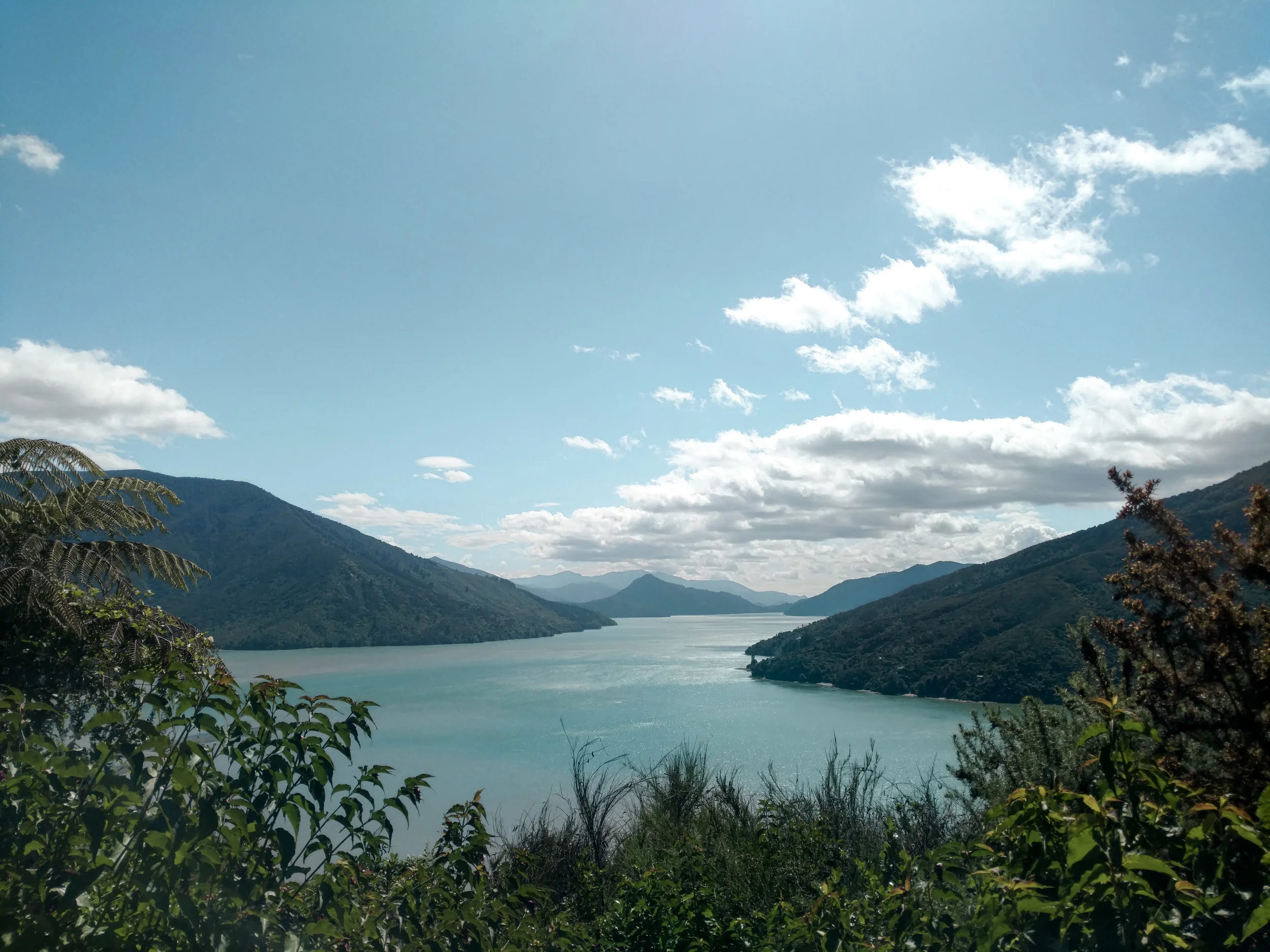
From St. Arnaud, Jonathan and I have an easy stroll along the shores of Lake Rotoiti -- one of the two glacial lakes that give the park its name. It's sunny and breezy, and every so often the trail takes us close enough to the lakeshore that we can sneak out onto the beach for a glimpse of the stunning view up the valley. We walk together, chatting and enjoying our morning stroll.

Soft lakeside trail covered in tiny beech leaves
photo/ Jonathan

Looking up Lake Rotoiti
photo/ Jonathan
At the end of the lake, we cross the inlet on a suspension bridge to begin a well-graded climb through the forest. We continue to follow the river upwards and find dozens of waterfalls cascading down toward the lake.

Cascades spilling down toward the trail
photo/ Jonathan

Travers Falls, 65 ft
photo/ Jonathan
Our hut for the night is located along a popular circuit through Nelson Lakes, so it's a big one with 24 bunks. Several groups have arrived before us and more thru-hikers wander in to join the lively conversation. A family arrives around 6pm with two small kids. The hut is already bustling and nearly full when a massive group shows up: 17 teenage girls with massive backpacks and three exhausted chaperones. Chaos ensues as the group scrambles to find some less-than-ideal tent sites around the full hut. We retreat to our bunk and listen to a podcast, one headphone each, as we fall asleep.
The alarm goes off at 5:30am the next morning, and we've got a long day ahead. We dress in the dark and try to be quiet as we repack our bags. Seven or eight of the teens are sleeping on the kitchen floor in the hut's only common area. Three or four other thru-hikers are the only other early risers and we make faces at each other as we creep around them. Though it's freezing cold outside, we're a bit relieved to be escaping.
The sun rises as we climb toward Upper Travers Saddle, our first pass for the day. The peaks all around us are tinged pink with alpenglow. On the saddle, the wind is whipping. I climb up on boulder and Jonathan snaps a picture, but we have to keep moving to stay warm.

Morning light near Upper Travers Saddle
photo/ Molly

Molly climbing around near Travers Peak
photo/ Jonathan
This will be one of our longest days on the trail, climbing up and over two steep and exposed passes on rough terrain. We spend most of the day grinding through the forest, but the rewards are memorable. After a long, steep descent from the first pass, our second climb takes us past Blue Lake, where we stop for lunch.
Blue Lake is famous for being the clearest lake in the world. When you look down at the bottom, you get the uncanny feeling that you wouldn't know there was water there if it weren't rippling in the breeze. From farther away, the lake shows off improbable shades of aquamarine and leaf green.
An entire bag of potato chips later, we're off again, climbing up to Lake Constance (Blue Lake's larger cousin). The final ascent to Waiau Pass is an ultra-steep scree slope rising 1500 feet in half a mile. But the views back toward Lake Constance are absolutely magical and the far side of the pass does not disappoint. The down climb is slow going, first scrambling down through the rocks, then slipping through mud and tussock.

Looking back at Lake Constance from Waiau Pass.
photo/ Jonathan

Molly looking epic AF
photo/ Jonathan

The view from the far side of Waiau Pass
photo/ Jonathan
Toward the end of the day, the trail flattens out, but we spend the last few hours dodging roots and holes, then hopping over fields of softball-sized rocks. The hut is full when we arrive, but we squeeze into a corner to escape the ravenous hoard of sandflies while we cook dinner. By the time we're laying in the tent, we are so, so ready for sleep.
The next section of trail is much flatter and our morning starts out smoothly. As we round a corner, though, we see a truck and a woman yells across the river, "Stop! Stop!" She shouts that we'll just have to wait; she's got a herd of wild horses and they're heading straight toward us.
"Wild horses?!"
We have no idea that there were wild horses in New Zealand at all, but we are about to get up close and personal. After sitting in the trail for a half hour, eating all of our snacks from boredom, we get another shout: "They're coming! Make noise!" We holler and wave our arms as thirty or forty horses thunder toward us, up the river. Maybe 100 feet away, they turn sharply up the bank and they're off. Stunned, we have nothing to do but wander up the trail.
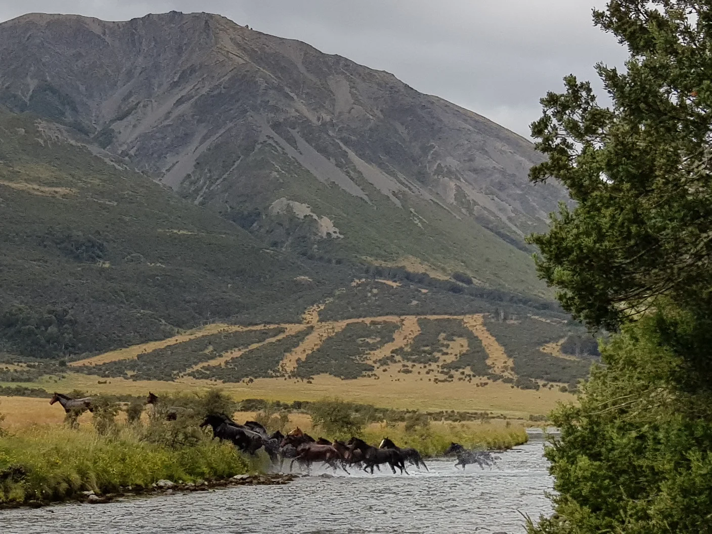
"A pack of wild horses raging across this river 100 feet away was one of the most cinematic experiences of my life."
photo/ Jonathan
The whole day feels surreal after that, helped along by some extremely strange weather. At one point, the sky glows an absolutely insane shade of blue:

How is that blue patch of clouds even real?! Believe it or not, that color is not artificial.
photo/ Jonathan
Later, the wind is so strong that we fight to stay upright. Here's Jonathan crawling his way across a suspension bridge swinging wildly back and forth with each gust:

That night, we share a large hut with just one other hiker and finally have some peace and quiet. We sit next to the large windows and watch the cold rain outside.

What We've Been Waiting For
As soon as we reached the foothils of the Richmond Range, Jonathan and I felt like we'd finally found the New Zealand we'd come to see.
As soon as we reached the forests of the Richmond Range, Jonathan and I felt like we'd finally found the New Zealand we'd come to see: big, rocky mountains, steep climbs, and epic views. With Colorado as our base for the last few years, this terrain made us feel right at home. By comparison, the whole rest of the trail suddenly felt like a warm up.
With perfect weather and a lot of stoke, we conquered this section in just four and a half days (the DOC-recommended time frame is 8-10). A lot of hikers around us seemed to struggle with the tougher terrain, however. When we arrived our first hut on day 1, they looked at us like we were monsters as we told them that we'd come from Havelock, 30 miles north.

photo/ Jonathan
Our second day in the Richmonds spanned one of the most memorable sections of the trail so far. Each heartbeat of the elevation profile brought us higher and higher until finally, right at the end of the day, we crested over a saddle where the view ahead was all jagged mountains and the view behind reached all the way back down to the ocean below. This was both one of the hardest days on trail and one of the most rewarding.

photo/ Jonathan
We shared our campsite at Slaty Hut that night with an awesome group of fellow hikers, some new friends and several that we'd caught up to again after our Wellington vacation. We ate dinner with Eran, an Israeli guy who we met way back on 90 mile beach, as well as Lancelot and Benjamin, two French Canadians we had met in Waikanae, Abby, another American, and Matthew, the only ultralight Kiwi on trail (it's a bit of a running joke for us that Kiwis seem to carry as much weight as they possibly can).
One more highlight that I'd be remiss to bypass? One of the huts had a flush toilet! This was obviously a major subject of discussion for thru-hikers and we'd all gone out of our way to visit. That's called #hikertrash luxury... Don't worry, we did not take a photo.
Everything about the Richmond Range was stunning. On day three, we climbed over two peaks, Mt. Rintoul and Little Rintoul, on the sketchiest and steepest trail so far. And on day four, we hiked up the Wairoa River then headed into the wild colors of the Red Hills. I think the photos of these sections probably speak best for themselves.

photo/ Jonathan

photo/ Jonathan

photo/ Jonathan

photo/ Molly

photo/ Molly

photo/ Jonathan

photo/ Jonathan

photo/ Jonathan
As will be common for most of the South Island, we passed backcountry huts every five miles or so. Here, the huts were crowded and a couple of nights, we actually opted to sleep in the tent just because the huts were so darn hot. But the huts were wonderful for taking midday breaks, giving us a brief refuge from the ever persistent sand flies, nasty little nibblers who give painful bites that drive you insane with itchiness the next day. They don't seem to bother us while hiking, but if you stop for too long, the swarm is never far behind.
With big miles and big mountains, our hiker hunger in this section reached a whole new level. We hiked into St. Arnaud with our food bags empty and headed straight for hot pies. Lucky for us, we happened to arrive on Sunday afternoon, just in time for the famous all-you-can-eat BBQ buffet at the Alpine Lodge. The lodge set up a hiker table (yea, they see us coming a mile away) and we all got our money's worth before staggering back to the hostel to sleep off the food coma.
From St. Arnaud, we head directly up into Nelson Lakes National Park with two more high elevation passes ahead. Bring on the mountains!
Quality Time with Queen Charlotte
What better way to start the South Island than with beautiful views of the sounds while hiking on easy trail. That's the Queen Charlotte Track.
The ferry across the Cook Strait between Wellington and Picton took three and a half hours. We spent less than an hour in Picton before shipping out on a second ferry to take us over to Ship Cove where we'd start walking south along the Queen Charlotte Track. On the way over, we made a quick pit stop at an island wildlife sanctuary where we got to see tiny penguins.

Tiny penguins! (They're wild, but have nested in a box set up by the NZ Department of Conservation that we were allowed to peek into.)
photo/ Molly
When we arrived at Ship Cove, we found a beautiful, wide trail with a mellow grade and stunning views out over Queen Charlotte Sound. Though we started after 3pm and intended to do just a couple of miles that first afternoon, we ended up hiking 12 miles out of pure joy. It felt so good to be back on the trail!

Great motivation for every climb
photo/ Jonathan

Post-dinner chai latte as it lightly rains outside on our first night back on trail
photo/ Jonathan

Waking up to smooth, cruisey trail? Yes, please!
photo/ Jonathan
With easy trail under our feet and gorgeous scenery to take in, this section flew by. The only thing to disturb our peace was the deafening roar of cicadas, which we admittedly drowned out with headphones after a couple of miles. Fun fact: New Zealand has the only high alpine cicadas in the world. That just means there's no escape... it's definitely one unique species that we're not excited to visit here.

Chilling through some flat forest
photo/ Jonathan
...with the occasional peek-a-boo!
photo/ Molly
Queen Charlotte was a surprisingly mellow introduction to the South Island, where we'd otherwise expected to find remote wilderness. Instead, this section was ridiculously well-manicured with private beaches, resorts, and campgrounds lining the trail. We opted to free camp (or "freedom camp," as they say here) as much as possible, though, and enjoyed a couple of days warming up for the Richmond Range. Soon we'll head up, up, up to some of the highest terrain on the trail, so we enjoyed the mellow ocean views while we had them.

photo/ Jonathan

photo/ Jonathan

The sun creeps over the hills as we finish up Queen Charlotte Track. It's been a pleasure.
photo/ Jonathan

Touristing in Welly World
Get sick, get better, drink beer, see the sights, and bid farewell to the North Island.
To celebrate finishing the North Island, Jonathan and I planned to take a few days off in Wellington. But the morning after we arrived, I got sick. Like, really sick. The kind of sick where you look down a hallway and think "I couldn't possibly make it that far." I stayed in bed for two full days after throwing up so violently that I literally put my foot through a wall. Not a great start.
Once again -- and this seems to be a theme here in New Zealand -- we were impossibly lucky to be staying with a friend, Roz, who gave us a cozy bed and place to stay for four days while I recovered. Roz was not only shockingly unfazed when I told her that I'd put a foot through her wall, but she also proceeded to offer up the Kiwi version of Pedialyte and to convince Jonathan not to feed me Vegimite on toast for my first post-sickness meal (really just heroic -- that stuff is revolting).

The pup, Ella, was very helpful during recovery time, though she was decidedly not supposed to be indoors. I'm very sorry for being a bad influence on the floof.
photo/ Jonathan
While I was out of commission, Jonathan began working on logistics for the South Island, sending food boxes ahead for the next two weeks. If you've ever wondered what this looks like, picture one of those shopping spree shows from the '90s where people just run through a grocery store clearing shelves into their cart. Then picture an over-packer trying to zip their carry-on while sitting on it like, "Nah, I don't need to check a bag."
We didn't get much exploring done in the first few days, but with the North Island behind us, we didn't really have anywhere to be, either. So, we decided to take a few more days to get to see this city that we'd heard so much about.
The first and most important thing we'd heard about Wellington was that it was the center of craft beer culture in New Zealand. Our other beer experiences in this country had been decidedly mediocre as a rule, so we looked forward to a frosty beverage or two. Welly had also been lauded as the country's cultural capital (in addition to being the actual capital, of course), so we were after some great food and sight-seeing.
On day 1 of touristing, we hit up Weta Workshop for their free tour (that's the studio that worked on all of the special effects and props for Lord of the Rings, designing all of the costumes and armour, simulating crowds for the battles, crafting non-human characters like Gollum, etc.). We also checked out a brewery called Garage Project where we sampled some local brews -- decidedly better than your average NZ fare -- and spent a few hours walking around Zealandia, a nature reserve where we got to see some rare birds and several Tuatara. For you nerds out there, the tuatara is the last remaining species of an order that thrived 200 million years ago during the age of dinosaurs. The rest of the species in the order went extinct over 60 million years ago, which makes this one kickass animal. It also has a third "parietal" eye on the top of its head and can live to be 100 years old.
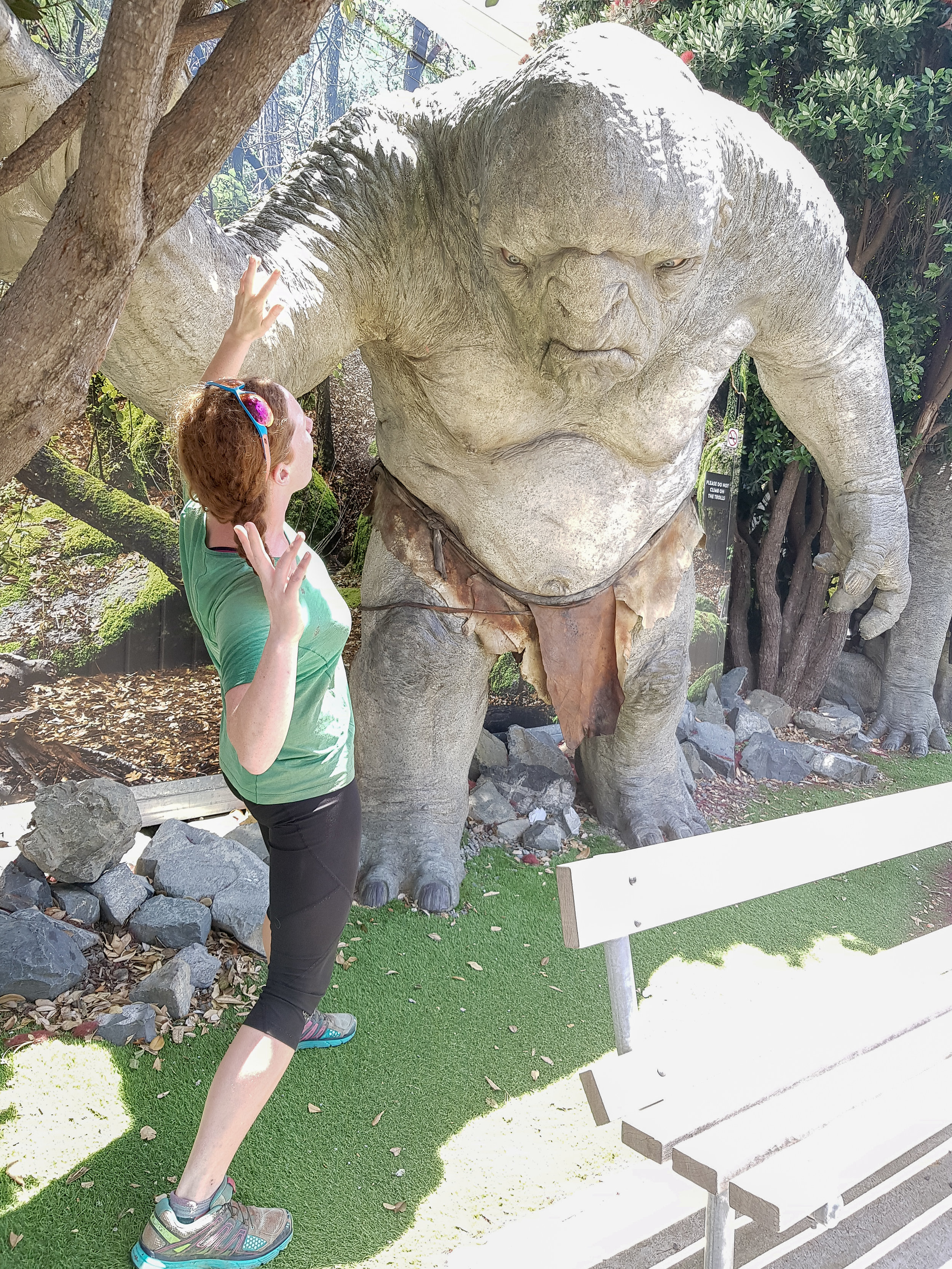
The cave troll from The Fellowship of the Ring outside of Weta Workshop
photo/ Jonathan

Some blinged out pigeons throwin down at Garage Project

A two foot long tuatara at Zealandia
photo/ Jonathan
On our second day exploring the city, we got some culture at the national museum, Te Papa, where we saw a huge exhibit about the ANZAC forces in Gallipoli during World War I. We also did some extensive exploration of the city's food culture. What a great time to be a hungry thru-hiker! Jonathan got his first dim-sum (called "yum cha" here) and we cashed in on a gift from my family to enjoy a phenomenal meal out on the town.

Desert excellence.
photo/ Molly

photo/ Jonathan
Our gift from afar also included a stay at a boutique hotel in a building restored from the 1930s right in the middle of downtown Wellington. The finishing touch to our night of indulgence was a bottle of perfect pinot noir from Central Otago.

Living a life of luxury.
photo/ Jonathan

Fancy mint on my pillow? Don't mind if I do.
photo/ Jonathan
On our final night in Wellington, we combined the two best themes of our time there: new friends and great food. Brett and Michelle, who we'd met hiking around Taranaki, invited us over for a phenomenal meal complete with homemade kombucha, delicious craft beer, and a rhubarb crisp that I would conquer nations to re-create. Apart from enjoying their excellent foodcraft, we loved hanging out with this pair and swapping stories -- it's not often that we meet people who adventure in the same way we do and who so deeply understand why we love big miles and ultra-wild places. Once again, in classic style, we were too busy enjoying ourselves to take a single photo. We swear that we've made real friends other than Charlie, even though he's the only one that ever shows up in our pictures...
Thank you so, so much to Ros for your out-of-this-world hospitality and travel beta, and thanks to Brett and Michelle for making Wellington such a welcoming stop along the trail. We both agreed that we'd willingly become vegan if Brett would just cook for us for the rest of our lives.
We couldn't be more stoked to start sharing stories about the epic mountains in the South Island, so stay tuned for another post coming soon as we start the Queen Charlotte Track!

Goodbye North Island!
photo/ Molly

Onwards to Wellington!
We wrap up the North Island with more beach than bush and get our first taste of Wellington.
From Waikanae to Wellington, Te Araroa becomes a lot more civilized. It wanders through a scenic estuary boardwalk, over a stunning coastal walkway, and along sandy beaches. On the first day, we got breakfast before leaving Waikanae, stopped for lunch along the beach, ate ice cream cones in Porirua, then nabbed a pre-dinner pie in Pukerua Bay before camping next to the ocean. Pretty good for 22 miles of walking, I'd say.

Molly surveying our final beach walk
photo/ Jonathan
Jonathan and Charlie get their feet wet at high tide
photo/ Molly

Ocean views from the Escarpment Track coastal walkway near Paekakariki
photo/ Jonathan

A massive suspension bridge along the Escarpment Track
photo/ Jonathan

HIKING SO HARD.
photo/ Molly

Beachfront camping with beautiful hiker trash
photo/ Jonathan
We had one of our odder camping experiences at a homestay just west of Wellington. Our host was an older gentleman, Alan, who met us in a dressing gown of some sort and apologized for being in his pajamas, though it was well after 4pm. Later, he found us drinking tea and offered us a "digestive" (sort of like a sweet cracker) because "that's what the queen has with her tea" (he was originally from Singapore and spoke with a distinct British accent). There were several other random people, clearly not hikers, who'd been living in the garden there for an indeterminate length of time. In the shower, there was a lengthy treatise on why one should dry oneself inside the shower and definitely not outside ("...you could even put your shirt on inside the shower and it would keep you nice and warm").
Unlike Auckland, Wellington does not sprawl for miles and miles. It is a smaller city, about 400 thousand people, tucked away at the southern tip of the North Island and bordered by water to the east and south. To the north and west of its small downtown are the foothills of the Tararuas. The city itself is built in and around the hills; it has tiny streets winding up and down them in what appears to be a completely patternless chaos. Downtown Wellington is right on the sound, with a beautiful waterfront full of public art and (somewhat shockingly) clean, sandy beaches.
We hiked into Welly, as it is fondly known here, over the top of Mt. Kaukau and wandered through the city's green spaces, walking through the botanic gardens directly down into the city center. The trail passes directly beneath the "Beehive," where New Zealand's government center is housed (look for it in the lower right side of the photo below -- you'll quickly understand the name).

Downtown Wellington from above
photo/ Jonathan

Hiker trash on Lambton Quay in Welly's city center
photo/ Jonathan

We ate delicious Vietnamese food at a place called "Where's Charlie?"
photo/ Jonathan
After downtown, the trail sneaks back into green space to head up Mount Victoria (where it also passes another LOTR filming location). We loved that even while passing through a major city, the trail was scenic and hilly, but the southern terminus of the North Island was a bit of a weird experience. We descended to a small city park where we wandered around for a bit before locating the tiny plaque signifying that we'd completed the North Island. Not exactly a grand finale... But then again, we still have another island still to go!

We finished the North Island!
photo/ Jonathan
The walk through Wellington was, overall, a completely different experience than hiking through Hamilton or Auckland. There was a ton of green space, beautiful ocean views, and some climbing to break up the day. We finished the day feeling excited to explore the rest of the city and ready for some well-deserved rest.

A Taste of the Tararuas
The infamous Tararuas turn out to be one of the toughest, and most rewarding sections of the trail so far.
For hundreds of kilometers, we'd been hearing about the mountains before Wellington from other hikers. "The Tararuas? That's supposed to be the hardest section of the whole trail," they'd say. Our notes cautioned us to carry extra food and be prepared to spend whole days in the huts if bad weather struck. We heard horror stories of gale force winds blowing hikers off ridgelines and many hikers were skipping the section altogether.
Needless to say, we left Palmerston North with great anticipation (and 7 bags of potato chips).
Though the Tararuas have a particularly infamous reputation, the trail only takes a quick dive into the range, about 60km (~40 miles) total. Normally, that would be about two days of hiking for us. Here, we planned for three full days while many of our peers planned for 5 or more.
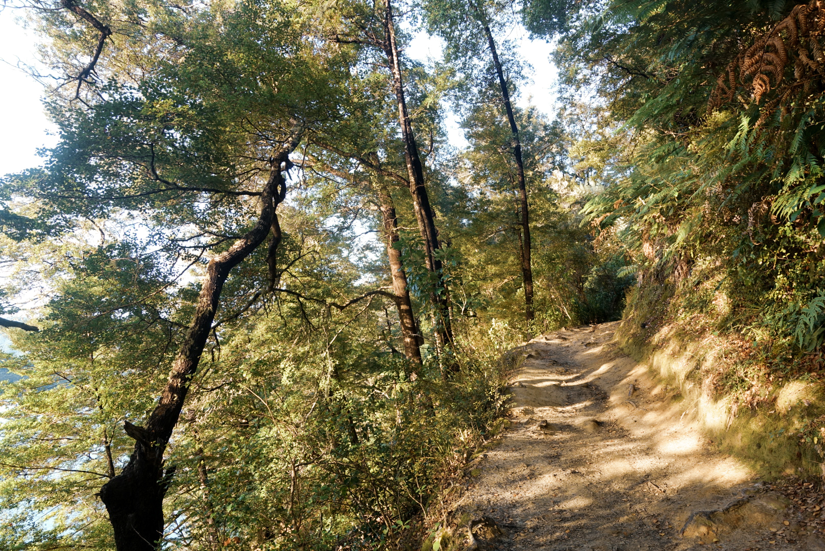
We spent the first day climbing up into the range, gaining over 3000ft in elevation. The climbing was steep and muddy at times, but nothing we hadn't encountered before in Ratea forest or near Mt. Pirongia. Though it was cool and windy all day, it did not begin to rain in earnest until we reached our home for the night at Te Matawai Hut.

Heavy mist on day #1 in the Tararuas
photo/ Jonathan

Typical New Zealand "trail"
photo/ Jonathan
In New Zealand, it's common practice for wilderness signs to give approximate times for travel between huts along with -- and frequently instead of -- actual distances. This is incredibly irritating, since we tend to move faster than most hikers and regularly beat the recommended time allotments by an hour or more. However, the time frames listed can sometimes help give an idea of how difficult the terrain is expected to be. When we left our hut on day 2, a sign warned that the next 5km (~3 miles) was expected to take us 6-7 hours. Ouch!
Though we didn't move quite as slowly as the sign projected, the second day in the Tararuas proved to be one of the hardest we've had on the trail so far. It took us 12 hours to do 20 kilometers (just over 12 miles). We were lucky to have great company for the day: Charlie was still traveling with us and we were also joined by another Brit, Andy, as well as an Italian, Alessio, and another American, Justin. We've rarely hiked with so many others on this trail, but the tough terrain was much more fun with a merry hiker train making jokes and swapping stories.

Hiker train!
photo/ Jonathan
Climbing up from Te Matawai, we summited a small peak, then followed a ridgeline for several miles. The ridge was narrow and instead of a rocky spine, the trail was a deep, muddy trench with steep little dips and dives and slippery tussocks along both sides. It was ridiculously slow going, plunging down into knee-deep mud with no escape.

photo/ Jonathan

photo/ Jonathan

Looking back, you can just glimpse Te Matawai Hut with it's little red roof.
photo/ Molly
As we reached the next hut, Dracophyllum, the scenery changed dramatically. We dropped into deep forest of gnarled, ancient beech. Moss covered every surface, so thick that we could plunge our trekking poles into the ground and find no resistance. The air was suddenly damp and cool, and the shade was complete, even under a bright midday sun. We breathed in the earthy smell of rain and soil and green, growing things, and felt like we had entered another realm.

photo/ Jonathan

photo/ Molly

photo/ Jonathan
Between patches of forest, we slipped and scrambled our way across rocky, sometimes muddy slopes to Nichols Hut. Te Araroa has large swaths of trail that are really not maintained as trails at all, but that remain footpaths simply because they are used by trampers. In this case, large sections of trail were completely crumbled away, so that we'd have to hold on to roots and clumps of grass as we hauled our packs up and down through gullies and over piles of downed trees. Luckily, the weather was clear and the final climb up to Mt. Crawford was a steady ascent on (gasp!) actual trail.

Heading up to Mt. Crawford
photo/ Jonathan

Charlie and Jonathan snacking it up on the summit
photo/ Molly
The final descent to Waitewaiwai Hut was ridiculously steep, like some sort of near-vertical forest obstacle course. We arrived at the hut completely exhausted, but still brave enough to jump into the freezing river to rinse off the mud.
What a day!
The final few kilometers of the Tararuas were much like the rest, but we only had one more peak to climb before reaching town at Waikanae. It was a tough section, but left us stoked for more hard mountain trekking as we came closer and closer to the South Island. Onwards to Wellington!

Mt. Taranaki: There and Back Again
When the prescribed trail sucks, you make your own adventure. This time it involved lots of hitchhiking and the best mountain summit we could ask for.
After the Whanganui River, Te Araroa is on paved road for nearly 100 kilometers, mainly along major highways. That's not exactly our idea of a great wilderness experience (plus, walking the roads would have meant spending my whole birthday roadwalking, and who wants that?). So, we decided to skip the whole section and take a suitable, homemade "alternate": hitchhiking 3 hours west from the town of Whanganui, climbing the iconic Mt. Taranaki (aka Mt. Egmont), and then hitching another 4 hours back south to Palmerston North, where Te Araroa heads back out onto real trail.
In total, it took us 3 hitches to get to Taranaki and 5 to get back to Palmerston North. I could probably write a whole post about each one. We've learned a massive amount from talking to locals, and we like to refer to hitchhiking as a sort of “locals roulette” where we meet an incredible variety of people with different backgrounds and perspectives. We nearly always climb out of one hitch with questions saved up for our next ride.
Our drivers on this trip ranged from mid-twenties to mid-sixties and our conversations spanned just as wide a range. One driver, a man about our age, worked as a journalist for a railway trade publication and we learned about international train infrastructure trends. In another car, our driver had a horrifying request: "Explain to me the American healthcare system,” he said. Jonathan and I just looked at each other and laughed... But we hacked our way through and in return, we learned a great deal about the very different healthcare system here.
We talked with drivers about gun rights, folk music, retirement, and gay marriage. Some of these things may seem controversial to Americans, but here, they're just not. It's pretty widely accepted here that gay people should be able to get married and that gun ownership should be regulated -- what seems to fascinate the Kiwis most is that these issues are so divisive in the States.
Our longest ride was two and a half hours with a young woman -- younger than me, anyway -- who wowed us with an extensive and articulately expressed understanding of American politics. She asked about cannabis and how it can simultaneously be federally illegal and yet also legal in our home state of Colorado (go ahead, try explaining this in a way that doesn't make our government sound completely insane). On the final leg of our journey, an older gentleman picked us up in his shiny new Jaguar. It was New Year's Eve and he was on his way to a dialysis appointment. He said wanted to get in one last good deed for 2018.
But back to my birthday, as we were hitching out of Whanganui...
It took us until mid afternoon to reach North Egmont, the town where we'd start our ascent of Taranaki and by the time we arrived, the visitor's center cafe was closed. All hope of a birthday lunch was dashed, and I was feeling very far away from home and from the people I love. If we’re being honest, I was probably more than a little hangry. It wasn't the best birthday morning I’ve ever had.
But things started turning around as my "American birthday" arrived (we're 18 hours ahead, so I casually added most of a day to my celebration). A few hiker friends showed up completely unexpectedly, and we even got some free sausage to add to our celebratory dinner of instant ramen. We had a stunning sunset to finish out the evening and went to bed early -- the alarm was set for 4am.

Halfway through a game of Spades with Troy and Sydney.
photo/ Jonathan
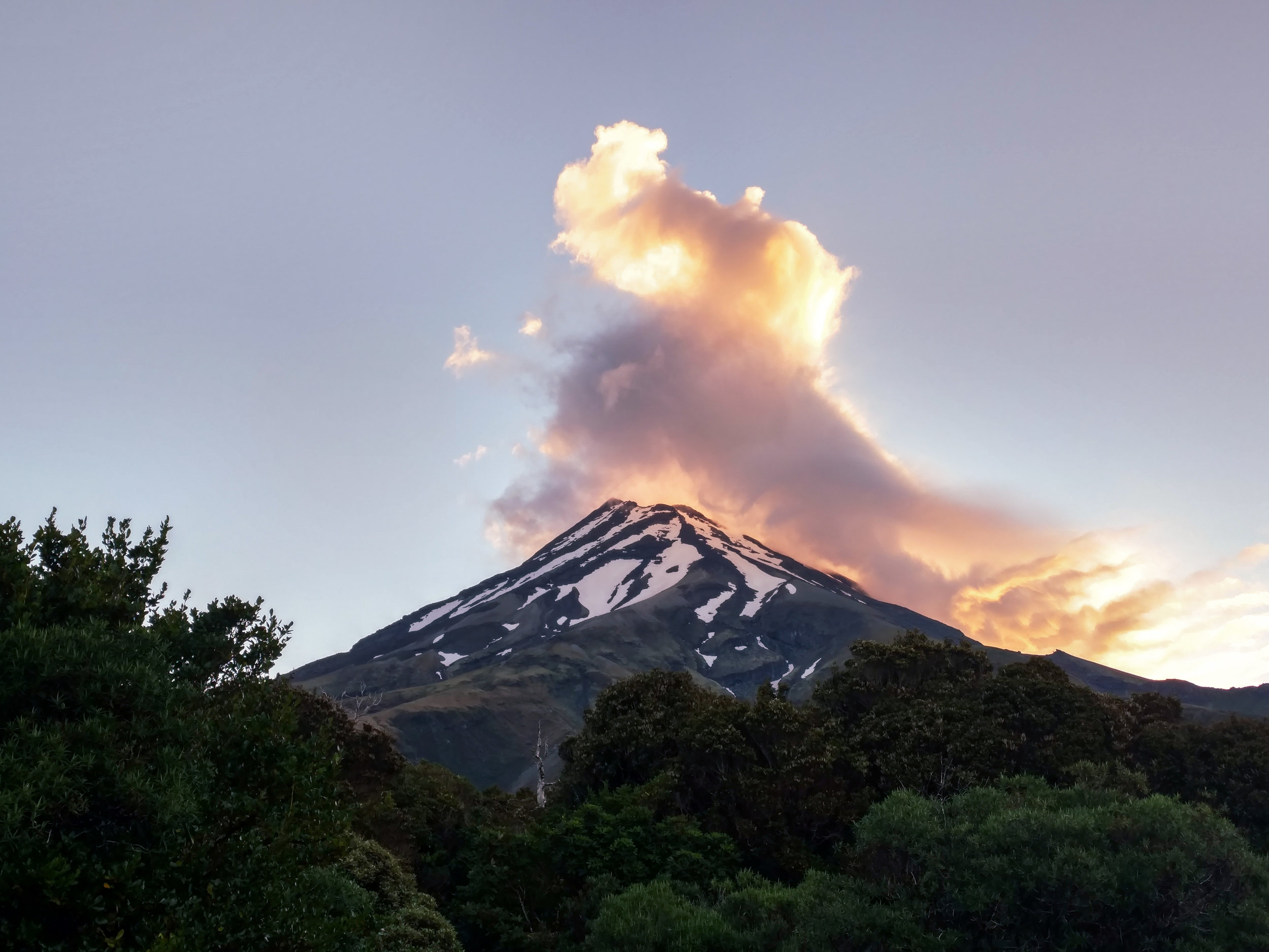
Sunset behind Taranaki
photo/ Molly
I love walking in the predawn hours, my whole world contained in the small circle of light from my headlamp. It was quiet, that morning; the birds had not yet sensed that day was arriving and we had the mountain all to ourselves. We reached treeline just as the first light was spilling over the horizon.

First light from the mountain
photo/ Jonathan

photo/ Troy Larson
The climb up Taranaki is steep -- over 4000 feet in just 3 kilometers (~2 miles). It felt good to be climbing, though. We huffed our way up “The Puffer” before reaching the notorious scree fields and felt a rush of relief when we finally made it to solid rock for the final scramble. When we arrived at the crater, the snow was just beginning to soften. Perfect timing! From there, we only had a short push to the small summit.

A view from The Puffer
photo/ Jonathan

Onwards and upwards
photo/ Troy Larson

Cheesin' near the top
photo/ Troy Larson

Jonathan climbing up through the crater
photo/ Molly
In the Maori tradition, Taranaki is said have fought with Mt. Tongariro over a lady mountain, Pihanga, and to have lost. In his grief, they say, Taranaki ran all the way to the west coast, leaving a deep gorge behind him that filled with his tears to form the Whanganui River (where we’d spent Christmas the week before). The mountain stands completely alone at the edge of the ocean, a perfectly conical volcano in a near-perfectly circular ring of wilderness. Far in the distance, we could see the peaks of Ngauruhoe and Ruapehu rising above the clouds.

photo/ Jonathan

photo/ Jonathan

photo/ Molly

Ngauruhoe and Ruapehu rise above the clouds in the distance, with the Shark's Tooth looming in the foreground
photo/ Jonathan
It took us about 6 hours round trip to complete the climb itself and as we shoe-skied down the scree fields, we patted ourselves on the back for waking up early. We'd had the summit all to ourselves, but a crowd of other hikers snaked out below us. We breezed down past them and made it back to the visitor's center while breakfast was still being served. Double victory!
However, we couldn't yet call our day complete. We wanted to check out some other views of the mountain, and specifically, we wanted to visit the tarns (seasonal alpine pools) where the mountain famously shows its epic reflection. To do that, we needed to hike another 12 km (~7.5 miles) over another mountain and on to the Pouakai Hut. The signs warned us that it would take 9 hours (presumably on fresh legs).
Once again, we wholeheartedly ignored the signs and set out around 1pm. The trail was muddy and steep and brutal for our already-tired legs. Nevertheless, we arrived at the tarn well before sunset. Crossing the boardwalk down to the water, we realized that the tarn was absurdly small, though it looks like a substantial lake in the many (many) Instagram photos from this spot. There was a group of tourists loitering around the tiny pool, waiting for the summit -- now cloaked in clouds -- to appear long enough for the perfect image.
With thick clouds and time to spare, we headed down to the hut for dinner. There, we met Brett and Michelle, a couple from Wellington who were hiking Taranaki's own Round the Mountain track. We sat and chatted until the sky outside began to look more promising, then hiked back up to the tarn to take our own turn waiting for the perfect shot. The sky was moody and there was too much wind for a clear reflection, but with patience, we had the chance to watch the mountain wrestle its way through the mist.

photo/ Jonathan
As the sun began to set on a long, long day, we walked back to the hut with our friends. Brett snapped a #brinsonbanksing moment for us as we reached a hill above the clouds. We climbed into our bunks that night, exhausted and at our very happiest.

photo/ Brett Halkett

photo/ Jonathan

Christmas on the River
A canoe trip down the river for Christmas? Sure, why not.
After a mad dash into National Park, Jonathan and I woke up early to catch the sunrise and call our families one last time before Christmas. It was December 23rd and for the next 5 days, we'd been told that there'd be no service at all.
We were heading out for 5 days on the Whanganui (wh pronounced as an f) and had hired a Deluxe Canadian Canoe for two. It was scheduled to meet us the following day -- Christmas Eve -- in the small village of Whakahoro, which meant we had a long, long, long day of roadwalking ahead of us. Thirty miles and many hours of podcasts later, we dragged our aching feet into camp.

#Mondayvibes
photo/ Jonathan
The next morning, we had a lovely Christmas Eve brunch at the Blue Duck Cafe with some hiker friends and met the canoes to get on the river.

We made it! Time to rest the sore feet for a few days.
photo/ Jonathan
One of the best parts of the river section for us hikers is that we don't have to worry about weight. That means we can eat (and, of course, drink) whatever we want! Almost, anyway. We left our resupply with the canoe company back in Tamarunui before the Tongariro Crossing and Round the Mountain tracks, so we couldn't have much in terms of fresh foods. However, we made the most of the boats by adding heavy refreshments like juice, almond milk, canned soup, and coconut cream to add to our curry.

Molly re-learning to steer a canoe after 20 years. Just like riding a bike!
photo/ Jonathan
Christmas Day was an extremely festive 55 degrees and raining. We sang several classic carols like "I'm dreaming of a wet Christmas," and "Paddling through a Winter Wonderland." In spite of the rain, however, spirits were high.

We're smiling because there's so much food and beer in those barrels.
photo/ some rando on the river
When the rain stopped, we had a... relaxing paddle down the river. Here's Molly hard at work in the front of the boat:

photo/ Jonathan
Christmas dinner consisted of canned Thai pumpkin soup, which we ate around a picnic table with two couples: two Brits and two German ladies, all of whom we'd just met the day before. We camped with a bunch of other hikers and stayed up drinking until all hours of the late evening (like... 9:30pm).
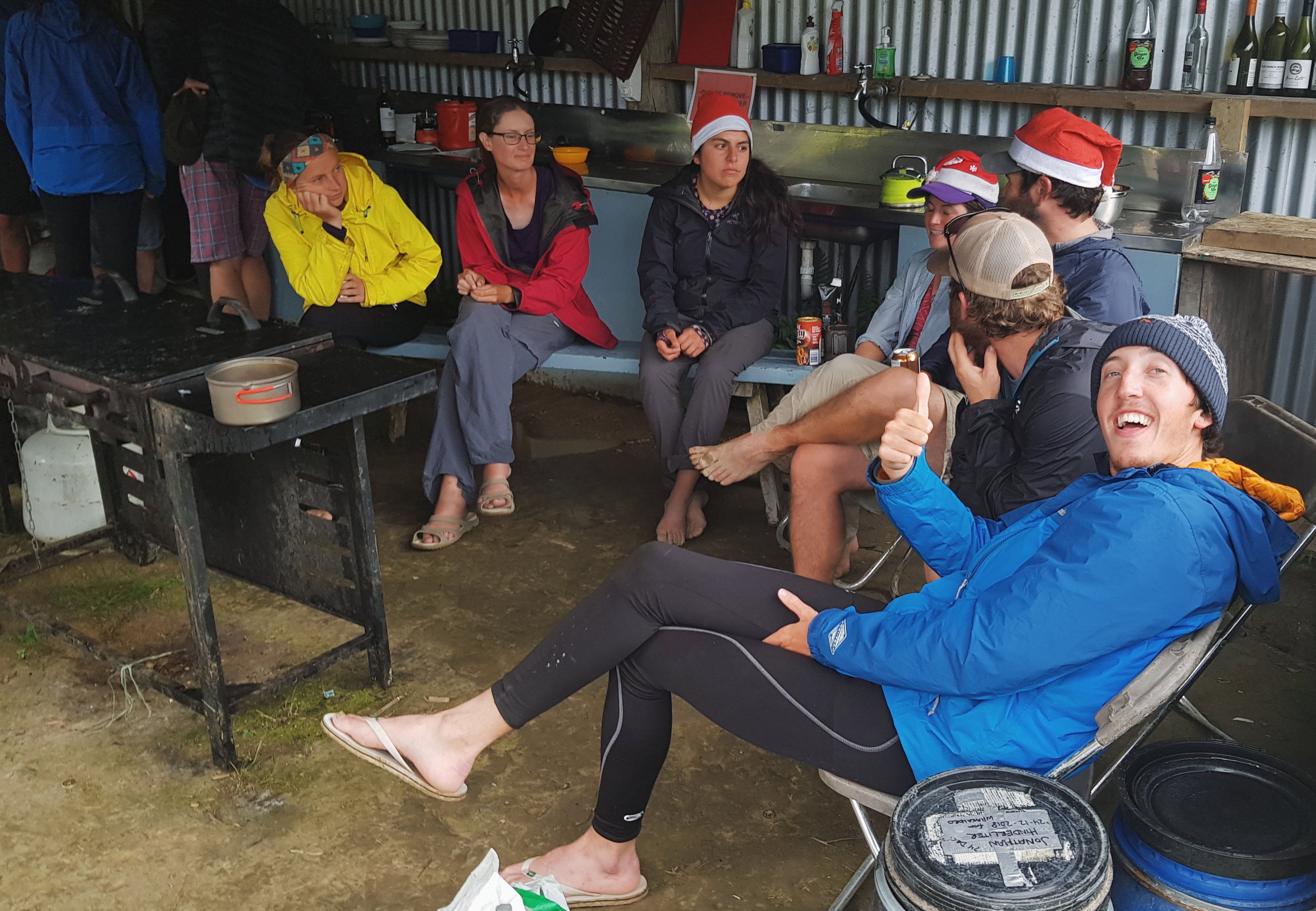
Charlie looking extremely festive with a bunch of other beautiful hiker trash
photo/ Jonathan
Luckily, the weather was much better for the final days of the trip and we loved getting to see the bush from a new perspective. We even found some unique New Zealand artifacts like pumice rocks so light that we'd find them floating down the river next to our canoe.

photo/ Jonathan
"What else floats in water?"
"...very small rocks?"
photo/ Jonathan
While there were rapids throughout the first days, I'd estimate that on day 4, we probably paddled about 40% of the time. There was a lot of extreme relaxation happening -- suitable for a Christmas holiday, I suppose, but we're not really much good at doing nothing. By the end of day 5, we were pretty ready to be done with the river. The Whanganui was a beautiful section of trail and it was great to rest our legs. But at the end of the day, I guess we just like to walk.

photo/ Molly
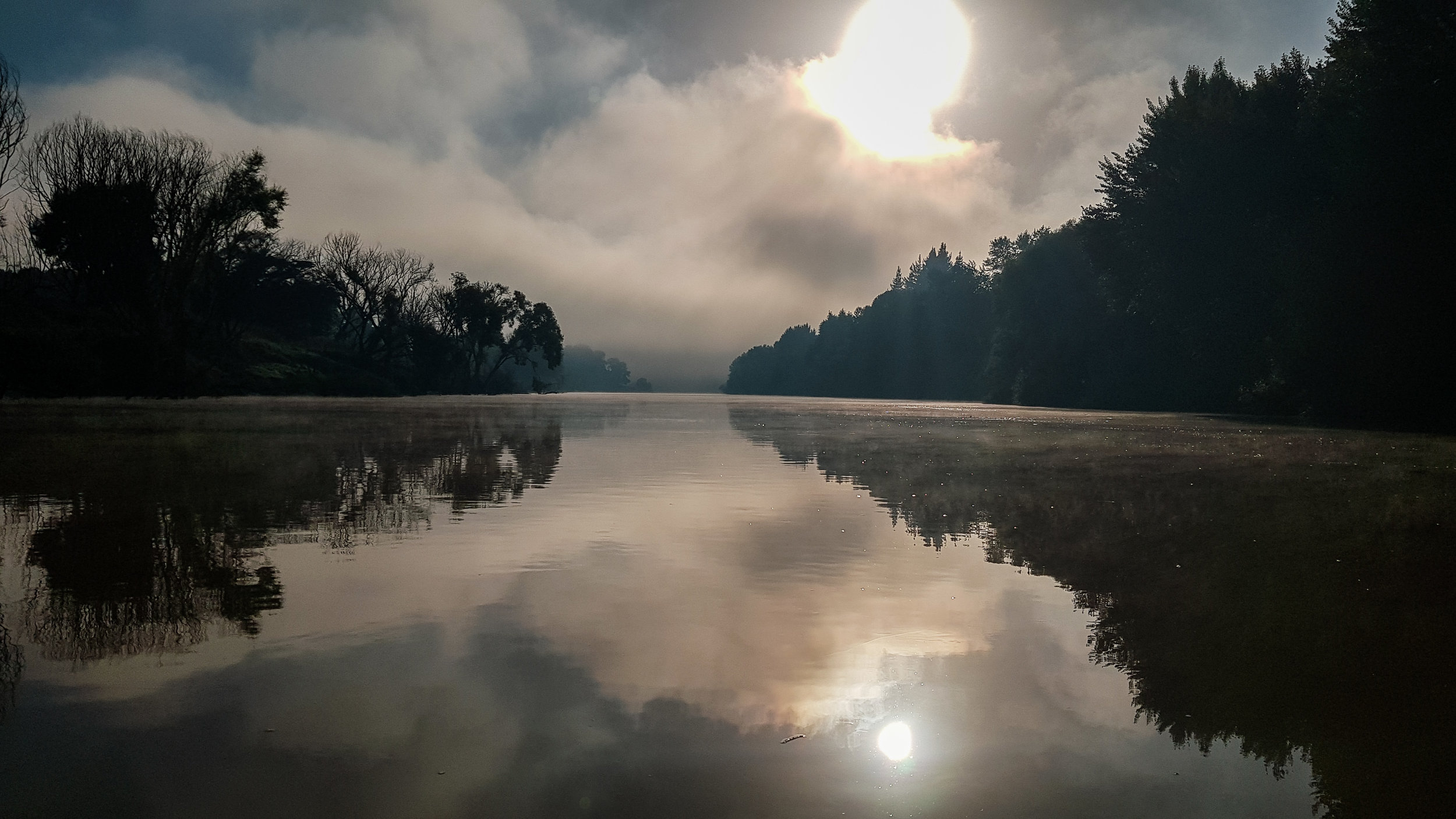
photo/ Jonathan

Charlie and Jonathan celebrating our arrival in the city of Whanganui
photo/ Jonathan

Round the Mountain
Let's take a side trip off trail around a massive, beautiful volcano.
Mt. Ngauruhoe may be New Zealand's most famous mountain (explanation here, in case you missed our last post), but it is not the largest or most impressive. In fact, its closest neighbor, Mt. Ruapehu, is over 1000 feet higher and far more massive. Ruapehu's highest peak, Tahurangi, stands at 2797 meters high (around 8400 feet) and boasts the North Island's only glaciers (so it is snow-capped year round). It is also still a highly active volcano; the last large eruption occured in 1996, but several smaller eruptions and lahars (large volcanic mudslides) have happened since.

photo/ Jonathan
Though we're here in New Zealand to hike Te Araroa, we've also flown halfway around the world to get here -- we're not about to miss out on amazing sights just because they're off of the defined route. Case in point: the official trail spends only one day (30km or so) in Tongariro National Park. How could we not want to explore more of this amazing place?!
The Round the Mountain track begins where the Tongariro Crossing ends, in the village of Whakapapa. It traverses between Ngauruhoe and Ruapehu, bends south to cross the Rangipo desert, then passes through deep beech forests high on the southern slopes of Ruapehu and crosses the epic Waihianoa Gorge. In total, it is just under 70km (~44 miles) of tough, remote terrain.
The suggested time frame for the hike is 4-6 days, so naturally, we decided to do it in 2...
NOTE: If you happen to be another hiker or traveler who's interested in adding this loop to your trip, I've added a bunch of extra info to the end of this post, including some links and resources that we found helpful, as well as some tips for TA hikers, specifically. Scroll down to check that out or read on to hear about our adventure!
The forecast for our side trip was mixed, but it looked like with a little luck, we might finally get a good look at Ruapehu, which had been hidden in the clouds since we arrived. We set out early from Whakapapa and the trail up to Waihohonu Hut was glorious. Though Ruapehu remained cloaked, we did get a couple more good looks at Ngauruhoe from the south.

photo/ Molly
As soon as we left Waihohonu Hut, the trail turned toward the Rangipo Desert and the landscape began to change. The alpine scrub thinned until we were left in a sea of rock and sand.

photo/ Molly
The desert was surreal after so many miles of dense, wet rainforest. And looking out across the undulating dunes, it was nearly impossible to guess how far we had come or how far we had yet to go.

photo/ Molly
After Rangipo Hut, the track climbed higher up into the mountain gullies, wrought from sharp, black volcanic rock. In the clouds, there were no sounds but the wind and the crunch of our footsteps.

photo/ Molly
In one valley, we found signs reading "EXTREME LAHAR DANGER." They cautioned us to move quickly through the next kilometer and not to pass through if we heard rumbling from above. A lahar is a massive mudslide caused by volcanic activity and the area was overdue. Definitely adds a little spice to constantly be reminded that you're hiking across an active volcano!
The valley was also insanely beautiful, with bright orange mineral deposits against the opaque, ice blue river. Jonathan lived dangerously and paused to snap a quick photo of me crossing a narrow suspension bridge. One person limit!

photo/ Jonathan
The end of the desert comes suddenly; a dense wall of beech forest seems to materialize from nothing, flowing upwards toward the summit over the bare lava. It is cool and shady under the trees and the trail is soft underfoot. Moss covers every surface and dampens the sound, so the world becomes quiet. I felt as though I should whisper.
It was raining as we crossed the boardwalk to our hut that evening, Mangaehuehu.

photo/ Molly
Day 2 was much clearer and the summit came out as we climbed Ohakune Mountain Road. The descent into the Mangaturuturu Valley was one of the most stunning parts of the hike. Everywhere around us, waterfalls poured from the cliffs and tumbled into cold, clear pools. And Ruapehu towered above.

photo/ Jonathan

photo/ Molly

photo/ Molly
The final push toward Whakapapaiti Hut brought the gnarliest trail of the route. The track itself was washed out into a 4-ft deep trench filled with slippery mud. We climbed through thick, high grasses and did our very best to stay vertical, hopping between rocks and holding on to bushes as we clambered up and down the steep gullies.
Our adventure ended with a bit of a race as we met up with the official TA again. Low on food, we needed to resupply in National Park before heading toward the Whanganui River for our canoe adventure. With the shop closing at 7pm, we thrashed our way through the brutal swampy terrain, each slipping and falling in the murky water more than once. But we managed to run the final 12 kilometers in under two hours, still, and made it to the shop with time to spare.
We rewarded ourselves with burgers and ice cream at the local dairy.
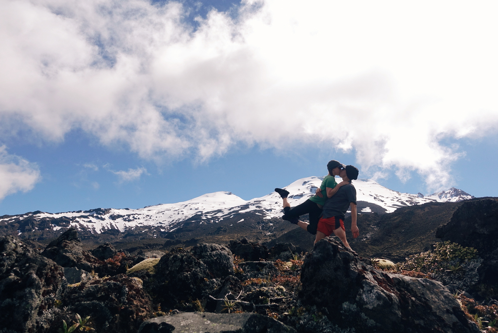
photo/ Jonathan
Ruapehu Round the Mountain Info for Hikers:
There are a few things that you need to know about this route before you head out. First, the piece on the Great Walk (between Whakapapa and Waihohonu Hut) is really quite mellow, but the rest of the trail gets a lot gnarlier. You may not go quite as fast as you think you will.
Second, remember that Waihohonu requires booking in advance -- it doesn't really make sense to stay there, anyway, but if you do, make sure it isn't booked up. Your hut pass won't apply there.
Finally, we used a bunch of resources to plan our trip, but the most helpful addition was this app for Android called NZ Topo Map. There's another one with a really similar name that we tested and that was totally useless, so make sure you get the right one! Iphone users may have more options -- if you use one you love, please add a link in the comments!
Here are a couple of other links to resources with detailed descriptions of the routes:
- The DOC site for Round the Mountain. Note that they don't include the ~3km or so ON the road in the totals (just up to and away from the road), so it's actually a bit farther than you think between the Mangahuehu and Mangaturuturu huts and there's a bunch of extra elevation gain.
- This ultrarunning site gives decent descriptions that add some additional terrain info and was the only place we could find info about the total elevation gain (~2000 meters).
- Michael Deckebach's blog is where we first found out about this trail and he has some additional info about this and other alternates for TA hikers.
If you decide to go clockwise, like we did, the hardest terrain is toward the end of the loop. However, there are some advantages for TA walkers in doing it this way: instead of going all the way back into Whakapapa, you can head out to Whakapapaiti hut and rejoin the TA as it passes out toward National Park.
One final note: everyone will recommend to you that this route should be done in 4-6 days. For us, doing it in 2 days (~35km each) worked out just fine. Be smart about your own fitness level and comfort, but if you're a fit hiker used to doing big miles, you may not need to plan quite so much time for the side trip.
Enjoy your hike!

Doomsday
And now, what you've all been waiting for... Mt. Doom!
And now, what you've all been waiting for...
Mt. Doom!
Or, more appropriately, Mt. Ngauruhoe (pronounced "na-re-HO-ee").
The famous mountain sits along the Tongariro Crossing, a well-traveled trail that makes up part of the Great Northern Circuit, one of the Great Walks that we’ve talked about in other posts. The Crossing is a high alpine route that passes through some of the most spectacular terrain on the North Island, topping out around 1850 meters (~5500ft). Mt. Ngauruhoe itself, famous -- of course -- for its role as Mount Doom in the Lord of Rings films, towers above the track at 2291 meters (~6900 ft). The trail also offers stunning over colorful alpine lakes and traverses the stark, barren volcanic landscapes used to craft the forbidding world of Mordor.
Charlie, Jonathan, and I left the Tongariro Holiday Park around 5am, just before first light, and as we reached the northern trailhead for the Crossing, a cold rain began to fall. We climbed through an eerily quiet forest as the rain clouds settled in above us and the temperature began to drop. Above treeline, where the wind whipped across us, we took refuge in an abandoned hut to discuss whether it was safe to continue upward. This is the unglamorous part of being in the mountains: shivering in a drafty hut with goat poop on the table and trash in the corners, doing pushups to stay warm.

Charlie, a British hiker we met a few weeks back, getting a spectacular view of the clouds.
photo/ Jonathan

Trying to stay warm in a very drafty hut while the deluge continued outside.
photo/ Jonathan
With only a few kilometers to go before the high point of the trail and another hut (a maintained one) waiting for us on the other side, we decided to make a go of it.
We soon warmed up again as we made the steep climb to Blue Lake, and as we rounded a corner into the large crater, the rain lightened and the clouds began to lift. Though not exactly ideal, our wet weather did have its upsides: When the sun is shining, tourist buses bring hundreds of novice hikers to flood the trail in a giant train heading north. Our rainy forecast had caused park rangers to cancel the bus services and by the time we saw another hiker, we had nearly reached the trail's high point. In total, we saw maybe 50 people on the trail that day, which seemed like a lot to us until we saw photos of the trail from the day before. When the sun was out, the crowd was -- quite literally -- 10 times as large.
The climb to the Crossing's high point is steep and scree-covered, but it offers phenomenal views out over the Green Lakes, which stand out in seafoam against the reddish volcanic soil. As we reached the top, with Ngauruhoe looming above us, the clouds that had shrouded the summit all morning cleared away. We had a glorious, if suitably moody view of Mount Doom and the Red Crater.

Charlie presses on toward the high point, with no one else in sight.
photo/ Jonathan

photo/ Molly

At last, we reach our goal. The epic views of Red Crater and Ngauruhoe.
photo/ Jonathan

Obligatory selfie in front of Ngauruhoe (Mount Doom).
photo/ Jonathan

Mount Doom seemed like a cool place for a #brinsonbanksing moment.
photo/ Charlie
We had intended to summit Ngauruhoe, but with storms brewing for the afternoon, we decided to play it safe and head down off the mountain. But obviously not before we did some LOTR reenactment...

"Come on, Mr. Frodo. I can't carry it for you, but I can carry you!" -Samwise Gamgee
photo/ Charlie
Ngauruhoe may have achieved international infamy as Mount Doom, but when you see it in person, it's actually dwarfed by a massive neighbor, Ruapehu. With a little window of time to spare before our date with the Whanganui River, we decided to trade a summit of Ngauruhoe for two days circumnavigating Ruapehu on the Round the Mountain track. More on that, coming soon!

One last look back at Ngaruhoe as we descend off its flanks.
photo/ Jonathan

The Wilderness Begins
As we moved south out of Hamilton, we found ourselves climbing Mt. Pirongia, doing our best to avoid hellish hoards of BlackBerry bush thorns, and hiking the lovely Timber Trail.
South of Hamilton, Te Araroa leaves the city streets and -- after a few hours of farmland and gravel road -- the steep climb up to Mt. Pirongia marks the beginning of real, sustained wilderness.
The bush on Pirongia is stunning; more open and airy than the Northland bush. Toward the top, the forest gives way to a dense, tall scrub (maybe 8-10 feet high) that creates a tunnel overhead. The peak itself is the highest point yet and it feels noticeably more alpine than anything we've seen so far. We made it to the mountains!

Heading up Pirongia, the sunlit forest covered in vines.
photo/ Jonathan
We reached another milestone just after the summit of Pirongia, as well: our first DOC hut. New Zealand has an extensive system of backcountry huts maintained by the Department of Conservation. We bought a 6-month backcountry hut pass for $92 NZD (~$65 USD) that covers nearly all of the huts on trail (No more paying for camping everywhere! Hooray!). The huts are more and more common the farther south we go, so we'll rely heavily on this pass, moving forward.
Pahautea Hut, our first one, is relatively new and quite large with space for 20 or so people in bunks and another 5-6 tent sites outside. There's a tap with potable water there and three "long drops" (the kiwi word for a privy). The hut has a large common space with cooking areas and long tables. It also has a wrap-around porch with a spectacular view out over the bush. For backcountry accomodations, the hut was pretty darn swanky.

Sunset from the porch at Pahautea Hut.
photo/ Jonathan
The DOC huts become gathering points for hikers and there were about 15 other TA walkers at the hut with us (the largest group we've seen so far). When we told the others that we planned to do 50km+ the next day, we got a few scoffs because of the tough terrain. But of course, nothing makes us want to do something more than someone telling us we can't...
Around 9am the next morning, we checked our progress and realized that the first 3km (~2 miles) had taken us nearly 3 hours. The mud was deeper and wetter than Ratea in places, and the climb down from Hihikiwi (a small summit after Pirongia) was steep and very slick. In spite of the slow start, however, we still made it to camp by dinnertime. First 50km day, complete!
But that most certainly wasn't the end of it; there was a lot more sufferfest to come.
After resupplying in Te Kuiti, we headed out of town on a poorly maintained trail covered in blackberry brambles. It was narrow and eroded, often leaving no more than a few muddy inches trying their damnedest to send us sliding down toward the river below.
In the morning, spider webs crowded the trail and -- since we desperately needed our poles to keep us on the mountain -- there was no protecting our faces from getting coated in sticky strands. Oh yea, and it was pouring rain. Of course. We deemed the section "blackberry fucking spider hell" and got through with a little blood and a lot of cursing.

This waterfall makes the trail here look much nicer than it was, but it's the only photo we've got of the whole section. Alas, no photos full of blackberry thorns and spiderwebs.
photo/ Jonathan
Thankfully, we had some good trail to look forward to in the following days. The Timber Trail is a popular cycling track, so it is wide, well maintained (and drained), and has a mellow grade throughout. It also passes through stunningly beautiful forest and on our first morning, we wandered through misty, moss-covered trees under a sunrise that turned our world bright green and gold.

Morning light on the Timber Trail.
photo/ Jonathan

Pristine trail in an other-worldly forest? Yes please!
photo/ Jonathan
We sped along with smooth trail underfoot, easily knocking out another 50km+ day (that's 30+ miles for you Yanks) and crossing our 1000km mark, too! Sometimes it's nice to just open up and hike big miles.
The Timber Trail also made for some scenic miles with neat features, including several huge suspension bridges and an old railway tunnel.

141 meter suspension bridge! So cool.
photo/ Jonathan

The track follows an old railway grade, sometimes carved through the rock with walls covered in moss a foot deep or more.
photo/ Molly

A perfect morning.
photo/ Jonathan
The Timber Trail would be an amazing addition to any New Zealand adventure by foot or by bike. So, check it out if you have the chance! End to end, the cycle track is 84km (52 miles), and we were passed by some cyclists riding it in a day. Here's some more info on the Timber Trail, in case you'd like to visit.
And finally, just because this trail never ceases to surprise us and because we have nowhere else to put these amazing photos....

We met an ostrich!
photo/ Jonathan

And Jonathan communed with it.
photo/ Molly
Up next: we check out the one and only Mount DOOM!